You are here: Home > Network List > TA - USArray Transportable Network (new EarthScope stations) Stations List
> Station I23K Minto, Yukon-Koyukuk, AK, USA > Earthquake Result Viewer
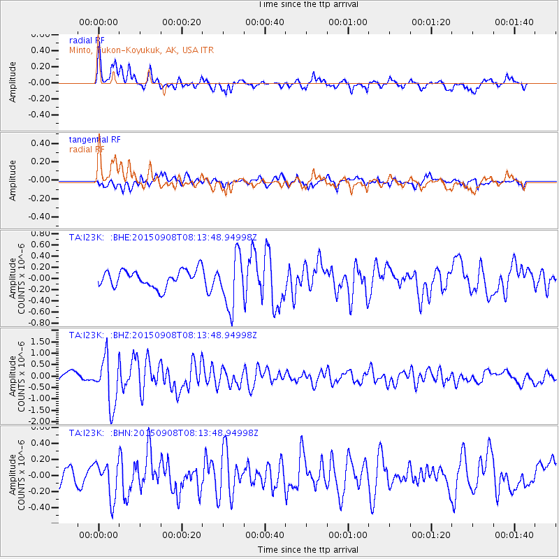
I23K Minto, Yukon-Koyukuk, AK, USA - Earthquake Result Viewer
*The percent match for this event was below the threshold and hence no stack was calculated.
| Earthquake location: |
Near Coast Of Chiapas, Mexico |
| Earthquake latitude/longitude: |
14.7/-93.9 |
| Earthquake time(UTC): |
2015/09/08 (251) 08:03:54 GMT |
| Earthquake Depth: |
4.1 km |
| Earthquake Magnitude: |
5.5 MB, 5.7 MWB |
| Earthquake Catalog/Contributor: |
NEIC PDE/NEIC COMCAT |
|
| Network: |
TA USArray Transportable Network (new EarthScope stations) |
| Station: |
I23K Minto, Yukon-Koyukuk, AK, USA |
| Lat/Lon: |
65.15 N/149.36 W |
| Elevation: |
149 m |
|
| Distance: |
62.6 deg |
| Az: |
336.915 deg |
| Baz: |
116.109 deg |
| Ray Param: |
$rayparam |
*The percent match for this event was below the threshold and hence was not used in the summary stack. |
|
| Radial Match: |
78.577 % |
| Radial Bump: |
395 |
| Transverse Match: |
73.478836 % |
| Transverse Bump: |
400 |
| SOD ConfigId: |
7422571 |
| Insert Time: |
2019-04-20 17:35:42.989 +0000 |
| GWidth: |
2.5 |
| Max Bumps: |
400 |
| Tol: |
0.001 |
|
Signal To Noise
| Channel | StoN | STA | LTA |
| TA:I23K: :BHZ:20150908T08:13:48.94998Z | 6.236882 | 1.0940522E-6 | 1.7541653E-7 |
| TA:I23K: :BHN:20150908T08:13:48.94998Z | 2.047934 | 2.3151533E-7 | 1.1304824E-7 |
| TA:I23K: :BHE:20150908T08:13:48.94998Z | 3.163644 | 4.740048E-7 | 1.4982874E-7 |
| Arrivals |
| Ps | |
| PpPs | |
| PsPs/PpSs | |


