You are here: Home > Network List > TA - USArray Transportable Network (new EarthScope stations) Stations List
> Station L04D Klamath Falls, OR, USA > Earthquake Result Viewer
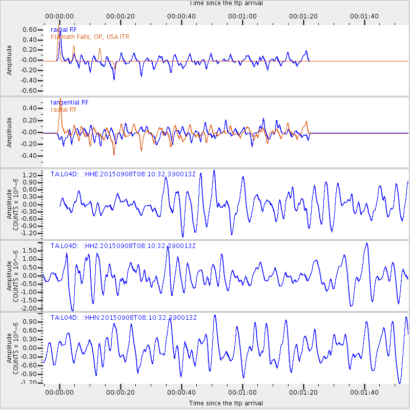
L04D Klamath Falls, OR, USA - Earthquake Result Viewer
*The percent match for this event was below the threshold and hence no stack was calculated.
| Earthquake location: |
Near Coast Of Chiapas, Mexico |
| Earthquake latitude/longitude: |
14.7/-93.9 |
| Earthquake time(UTC): |
2015/09/08 (251) 08:03:54 GMT |
| Earthquake Depth: |
4.1 km |
| Earthquake Magnitude: |
5.5 MB, 5.7 MWB |
| Earthquake Catalog/Contributor: |
NEIC PDE/NEIC COMCAT |
|
| Network: |
TA USArray Transportable Network (new EarthScope stations) |
| Station: |
L04D Klamath Falls, OR, USA |
| Lat/Lon: |
42.22 N/122.30 W |
| Elevation: |
1437 m |
|
| Distance: |
36.8 deg |
| Az: |
323.828 deg |
| Baz: |
129.738 deg |
| Ray Param: |
$rayparam |
*The percent match for this event was below the threshold and hence was not used in the summary stack. |
|
| Radial Match: |
71.87925 % |
| Radial Bump: |
367 |
| Transverse Match: |
66.80247 % |
| Transverse Bump: |
400 |
| SOD ConfigId: |
7422571 |
| Insert Time: |
2019-04-20 17:35:54.018 +0000 |
| GWidth: |
2.5 |
| Max Bumps: |
400 |
| Tol: |
0.001 |
|
Signal To Noise
| Channel | StoN | STA | LTA |
| TA:L04D: :HHZ:20150908T08:10:32.390013Z | 4.3263144 | 1.0617109E-6 | 2.454077E-7 |
| TA:L04D: :HHN:20150908T08:10:32.390013Z | 0.8692583 | 3.103379E-7 | 3.5701459E-7 |
| TA:L04D: :HHE:20150908T08:10:32.390013Z | 2.4151227 | 5.072338E-7 | 2.1002401E-7 |
| Arrivals |
| Ps | |
| PpPs | |
| PsPs/PpSs | |


