You are here: Home > Network List > UW - Pacific Northwest Regional Seismic Network Stations List
> Station UMAT Pilot Rock, OR, USA > Earthquake Result Viewer
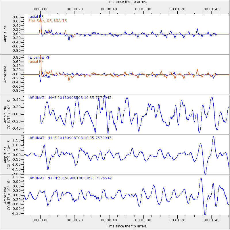
UMAT Pilot Rock, OR, USA - Earthquake Result Viewer
*The percent match for this event was below the threshold and hence no stack was calculated.
| Earthquake location: |
Near Coast Of Chiapas, Mexico |
| Earthquake latitude/longitude: |
14.7/-93.9 |
| Earthquake time(UTC): |
2015/09/08 (251) 08:03:54 GMT |
| Earthquake Depth: |
4.1 km |
| Earthquake Magnitude: |
5.5 MB, 5.7 MWB |
| Earthquake Catalog/Contributor: |
NEIC PDE/NEIC COMCAT |
|
| Network: |
UW Pacific Northwest Regional Seismic Network |
| Station: |
UMAT Pilot Rock, OR, USA |
| Lat/Lon: |
45.29 N/118.96 W |
| Elevation: |
1318 m |
|
| Distance: |
37.2 deg |
| Az: |
330.307 deg |
| Baz: |
137.222 deg |
| Ray Param: |
$rayparam |
*The percent match for this event was below the threshold and hence was not used in the summary stack. |
|
| Radial Match: |
73.51763 % |
| Radial Bump: |
357 |
| Transverse Match: |
52.271763 % |
| Transverse Bump: |
400 |
| SOD ConfigId: |
7422571 |
| Insert Time: |
2019-04-20 17:36:56.450 +0000 |
| GWidth: |
2.5 |
| Max Bumps: |
400 |
| Tol: |
0.001 |
|
Signal To Noise
| Channel | StoN | STA | LTA |
| UW:UMAT: :HHZ:20150908T08:10:35.757994Z | 4.845658 | 7.607167E-7 | 1.5698936E-7 |
| UW:UMAT: :HHN:20150908T08:10:35.757994Z | 2.2929769 | 3.4337188E-7 | 1.4974938E-7 |
| UW:UMAT: :HHE:20150908T08:10:35.757994Z | 1.4285663 | 2.945036E-7 | 2.0615326E-7 |
| Arrivals |
| Ps | |
| PpPs | |
| PsPs/PpSs | |


