You are here: Home > Network List > GS - US Geological Survey Networks Stations List
> Station KAN13 Rinehart Farm > Earthquake Result Viewer
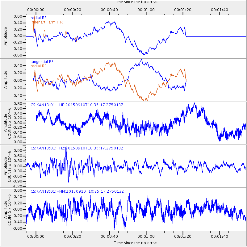
KAN13 Rinehart Farm - Earthquake Result Viewer
*The percent match for this event was below the threshold and hence no stack was calculated.
| Earthquake location: |
Fox Islands, Aleutian Islands |
| Earthquake latitude/longitude: |
52.2/-169.6 |
| Earthquake time(UTC): |
2015/09/10 (253) 10:26:47 GMT |
| Earthquake Depth: |
38 km |
| Earthquake Magnitude: |
5.9 MWP, 5.9 MI |
| Earthquake Catalog/Contributor: |
NEIC PDE/NEIC COMCAT |
|
| Network: |
GS US Geological Survey Networks |
| Station: |
KAN13 Rinehart Farm |
| Lat/Lon: |
37.01 N/97.48 W |
| Elevation: |
340 m |
|
| Distance: |
51.4 deg |
| Az: |
77.028 deg |
| Baz: |
311.417 deg |
| Ray Param: |
$rayparam |
*The percent match for this event was below the threshold and hence was not used in the summary stack. |
|
| Radial Match: |
45.55216 % |
| Radial Bump: |
400 |
| Transverse Match: |
33.096355 % |
| Transverse Bump: |
400 |
| SOD ConfigId: |
7422571 |
| Insert Time: |
2019-04-20 17:53:09.902 +0000 |
| GWidth: |
2.5 |
| Max Bumps: |
400 |
| Tol: |
0.001 |
|
Signal To Noise
| Channel | StoN | STA | LTA |
| GS:KAN13:01:HHZ:20150910T10:35:17.275013Z | 1.6621971 | 2.4675563E-7 | 1.4845149E-7 |
| GS:KAN13:01:HHN:20150910T10:35:17.275013Z | 1.3909085 | 1.8907832E-7 | 1.3593873E-7 |
| GS:KAN13:01:HHE:20150910T10:35:17.275013Z | 1.0559996 | 2.5969072E-7 | 2.4591932E-7 |
| Arrivals |
| Ps | |
| PpPs | |
| PsPs/PpSs | |


