You are here: Home > Network List > TA - USArray Transportable Network (new EarthScope stations) Stations List
> Station L20K Farewell, AK, USA > Earthquake Result Viewer
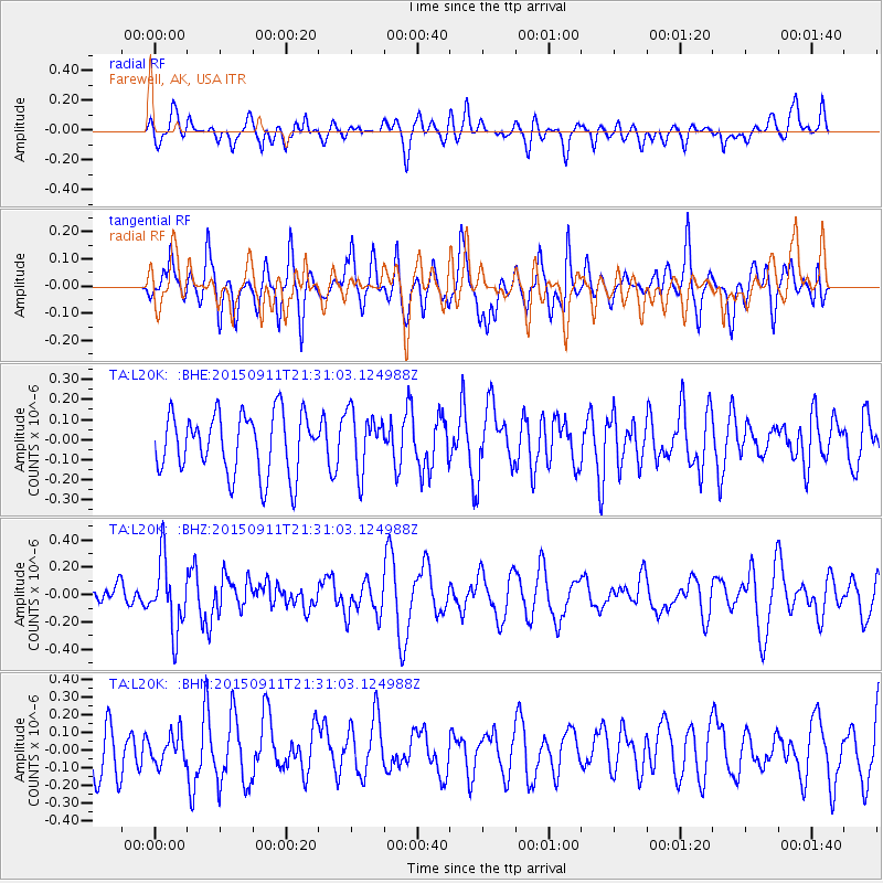
L20K Farewell, AK, USA - Earthquake Result Viewer
*The percent match for this event was below the threshold and hence no stack was calculated.
| Earthquake location: |
Eastern New Guinea Reg., P.N.G. |
| Earthquake latitude/longitude: |
-6.0/146.7 |
| Earthquake time(UTC): |
2015/09/11 (254) 21:19:19 GMT |
| Earthquake Depth: |
30 km |
| Earthquake Magnitude: |
5.5 MB, 5.4 MWB |
| Earthquake Catalog/Contributor: |
NEIC PDE/NEIC COMCAT |
|
| Network: |
TA USArray Transportable Network (new EarthScope stations) |
| Station: |
L20K Farewell, AK, USA |
| Lat/Lon: |
62.48 N/153.88 W |
| Elevation: |
673 m |
|
| Distance: |
81.8 deg |
| Az: |
23.844 deg |
| Baz: |
239.948 deg |
| Ray Param: |
$rayparam |
*The percent match for this event was below the threshold and hence was not used in the summary stack. |
|
| Radial Match: |
45.46398 % |
| Radial Bump: |
400 |
| Transverse Match: |
62.161087 % |
| Transverse Bump: |
400 |
| SOD ConfigId: |
7422571 |
| Insert Time: |
2019-04-20 18:05:01.299 +0000 |
| GWidth: |
2.5 |
| Max Bumps: |
400 |
| Tol: |
0.001 |
|
Signal To Noise
| Channel | StoN | STA | LTA |
| TA:L20K: :BHZ:20150911T21:31:03.124988Z | 2.8894567 | 2.5369621E-7 | 8.7800665E-8 |
| TA:L20K: :BHN:20150911T21:31:03.124988Z | 0.524231 | 8.307732E-8 | 1.5847463E-7 |
| TA:L20K: :BHE:20150911T21:31:03.124988Z | 0.88653845 | 1.3231643E-7 | 1.4925064E-7 |
| Arrivals |
| Ps | |
| PpPs | |
| PsPs/PpSs | |


