You are here: Home > Network List > TA - USArray Transportable Network (new EarthScope stations) Stations List
> Station O03E Paynes Creek, CA, USA > Earthquake Result Viewer
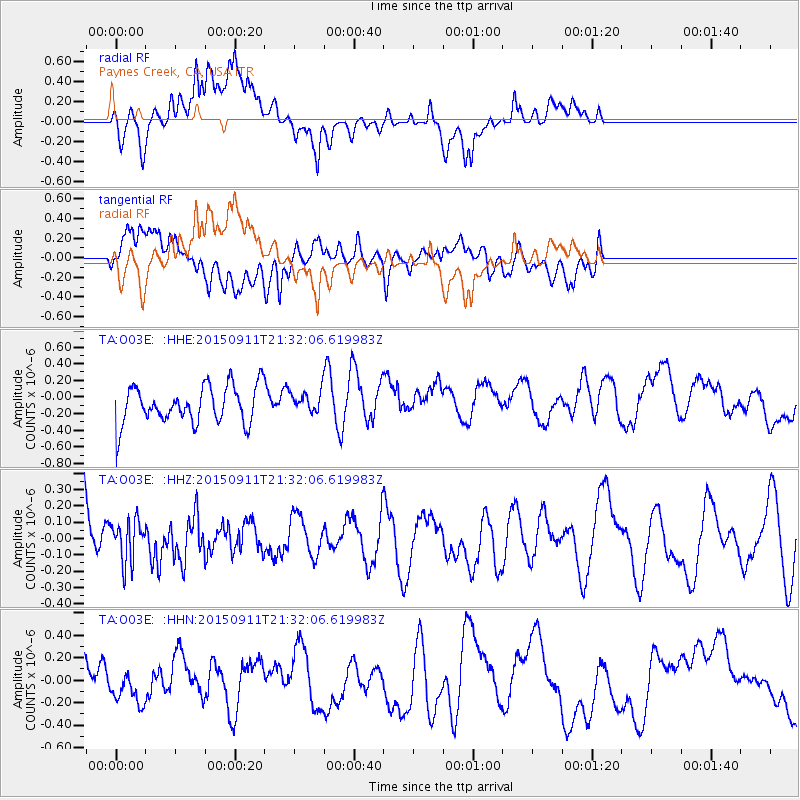
O03E Paynes Creek, CA, USA - Earthquake Result Viewer
*The percent match for this event was below the threshold and hence no stack was calculated.
| Earthquake location: |
Eastern New Guinea Reg., P.N.G. |
| Earthquake latitude/longitude: |
-6.0/146.7 |
| Earthquake time(UTC): |
2015/09/11 (254) 21:19:19 GMT |
| Earthquake Depth: |
30 km |
| Earthquake Magnitude: |
5.5 MB, 5.4 MWB |
| Earthquake Catalog/Contributor: |
NEIC PDE/NEIC COMCAT |
|
| Network: |
TA USArray Transportable Network (new EarthScope stations) |
| Station: |
O03E Paynes Creek, CA, USA |
| Lat/Lon: |
40.29 N/121.80 W |
| Elevation: |
967 m |
|
| Distance: |
95.0 deg |
| Az: |
50.13 deg |
| Baz: |
266.436 deg |
| Ray Param: |
$rayparam |
*The percent match for this event was below the threshold and hence was not used in the summary stack. |
|
| Radial Match: |
57.970848 % |
| Radial Bump: |
400 |
| Transverse Match: |
52.85942 % |
| Transverse Bump: |
400 |
| SOD ConfigId: |
7422571 |
| Insert Time: |
2019-04-20 18:05:04.390 +0000 |
| GWidth: |
2.5 |
| Max Bumps: |
400 |
| Tol: |
0.001 |
|
Signal To Noise
| Channel | StoN | STA | LTA |
| TA:O03E: :HHZ:20150911T21:32:06.619983Z | 0.75920683 | 1.2931167E-7 | 1.703247E-7 |
| TA:O03E: :HHN:20150911T21:32:06.619983Z | 0.68983483 | 1.538773E-7 | 2.2306396E-7 |
| TA:O03E: :HHE:20150911T21:32:06.619983Z | 1.0012426 | 2.0758776E-7 | 2.0733012E-7 |
| Arrivals |
| Ps | |
| PpPs | |
| PsPs/PpSs | |


