You are here: Home > Network List > CN - Canadian National Seismograph Network Stations List
> Station INK INUVIK, NT > Earthquake Result Viewer
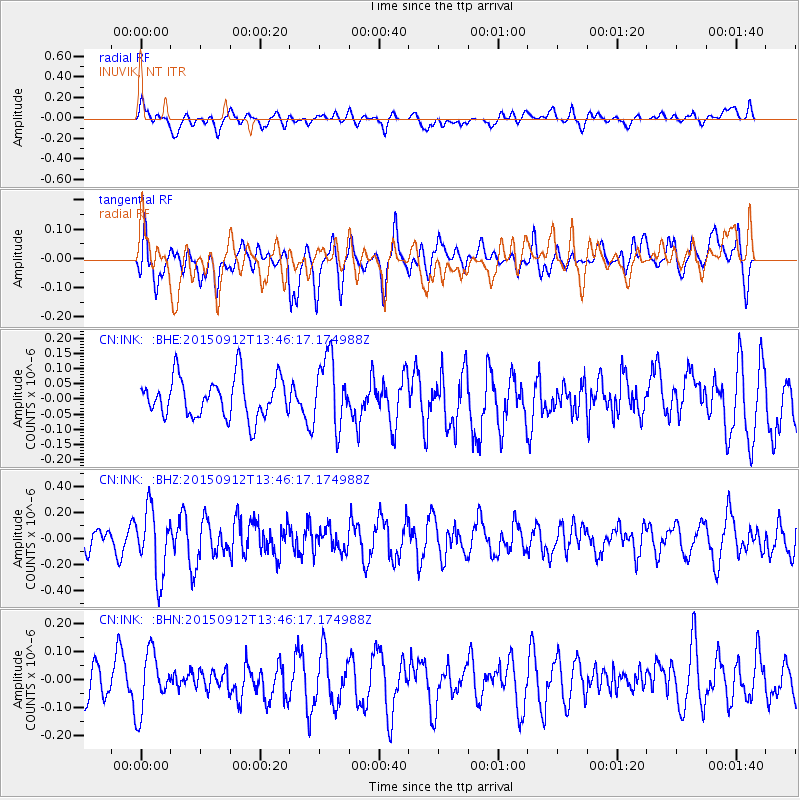
INK INUVIK, NT - Earthquake Result Viewer
*The percent match for this event was below the threshold and hence no stack was calculated.
| Earthquake location: |
Hokkaido, Japan Region |
| Earthquake latitude/longitude: |
41.9/142.6 |
| Earthquake time(UTC): |
2015/09/12 (255) 13:38:01 GMT |
| Earthquake Depth: |
49 km |
| Earthquake Magnitude: |
5.5 mwc |
| Earthquake Catalog/Contributor: |
NEIC PDE/ |
|
| Network: |
CN Canadian National Seismograph Network |
| Station: |
INK INUVIK, NT |
| Lat/Lon: |
68.31 N/133.53 W |
| Elevation: |
44 m |
|
| Distance: |
49.6 deg |
| Az: |
29.015 deg |
| Baz: |
283.107 deg |
| Ray Param: |
$rayparam |
*The percent match for this event was below the threshold and hence was not used in the summary stack. |
|
| Radial Match: |
50.43186 % |
| Radial Bump: |
400 |
| Transverse Match: |
50.8247 % |
| Transverse Bump: |
400 |
| SOD ConfigId: |
7422571 |
| Insert Time: |
2019-04-20 18:09:44.153 +0000 |
| GWidth: |
2.5 |
| Max Bumps: |
400 |
| Tol: |
0.001 |
|
Signal To Noise
| Channel | StoN | STA | LTA |
| CN:INK: :BHZ:20150912T13:46:17.174988Z | 2.649493 | 2.5535422E-7 | 9.637852E-8 |
| CN:INK: :BHN:20150912T13:46:17.174988Z | 1.2400151 | 1.03862135E-7 | 8.375877E-8 |
| CN:INK: :BHE:20150912T13:46:17.174988Z | 1.7287269 | 1.12834314E-7 | 6.5270186E-8 |
| Arrivals |
| Ps | |
| PpPs | |
| PsPs/PpSs | |


