You are here: Home > Network List > GS - US Geological Survey Networks Stations List
> Station KAN13 Rinehart Farm > Earthquake Result Viewer
KAN13 Rinehart Farm - Earthquake Result Viewer
*The percent match for this event was below the threshold and hence no stack was calculated.
| Earthquake location: |
Hokkaido, Japan Region |
| Earthquake latitude/longitude: |
41.9/142.6 |
| Earthquake time(UTC): |
2015/09/12 (255) 13:38:01 GMT |
| Earthquake Depth: |
49 km |
| Earthquake Magnitude: |
5.5 mwc |
| Earthquake Catalog/Contributor: |
NEIC PDE/ |
|
| Network: |
GS US Geological Survey Networks |
| Station: |
KAN13 Rinehart Farm |
| Lat/Lon: |
37.01 N/97.48 W |
| Elevation: |
340 m |
|
| Distance: |
84.2 deg |
| Az: |
44.241 deg |
| Baz: |
319.406 deg |
| Ray Param: |
$rayparam |
*The percent match for this event was below the threshold and hence was not used in the summary stack. |
|
| Radial Match: |
61.383434 % |
| Radial Bump: |
400 |
| Transverse Match: |
60.16446 % |
| Transverse Bump: |
400 |
| SOD ConfigId: |
7422571 |
| Insert Time: |
2019-04-20 18:10:33.801 +0000 |
| GWidth: |
2.5 |
| Max Bumps: |
400 |
| Tol: |
0.001 |
|
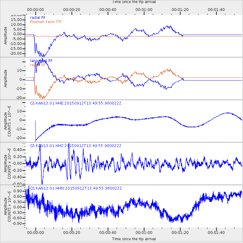
Signal To Noise
| Channel | StoN | STA | LTA |
| GS:KAN13:01:HHZ:20150912T13:49:55.960022Z | 2.6775084 | 2.8202632E-7 | 1.0533164E-7 |
| GS:KAN13:01:HHN:20150912T13:49:55.960022Z | 0.80502117 | 2.6400855E-7 | 3.279523E-7 |
| GS:KAN13:01:HHE:20150912T13:49:55.960022Z | 1.3822483 | 7.0716833E-6 | 5.116073E-6 |
| Arrivals |
| Ps | |
| PpPs | |
| PsPs/PpSs | |


