You are here: Home > Network List > IW - Intermountain West Stations List
> Station MOOW Moose Ponds, Wyoming, USA > Earthquake Result Viewer
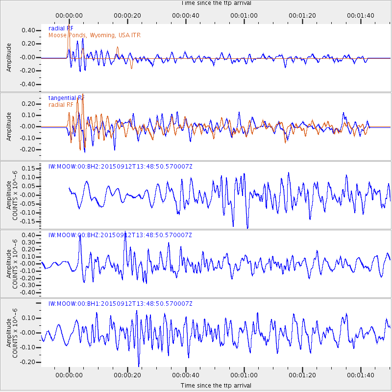
MOOW Moose Ponds, Wyoming, USA - Earthquake Result Viewer
*The percent match for this event was below the threshold and hence no stack was calculated.
| Earthquake location: |
Hokkaido, Japan Region |
| Earthquake latitude/longitude: |
41.9/142.6 |
| Earthquake time(UTC): |
2015/09/12 (255) 13:38:01 GMT |
| Earthquake Depth: |
49 km |
| Earthquake Magnitude: |
5.5 mwc |
| Earthquake Catalog/Contributor: |
NEIC PDE/ |
|
| Network: |
IW Intermountain West |
| Station: |
MOOW Moose Ponds, Wyoming, USA |
| Lat/Lon: |
43.75 N/110.74 W |
| Elevation: |
2128 m |
|
| Distance: |
72.3 deg |
| Az: |
46.798 deg |
| Baz: |
311.331 deg |
| Ray Param: |
$rayparam |
*The percent match for this event was below the threshold and hence was not used in the summary stack. |
|
| Radial Match: |
51.786346 % |
| Radial Bump: |
400 |
| Transverse Match: |
62.037556 % |
| Transverse Bump: |
400 |
| SOD ConfigId: |
7422571 |
| Insert Time: |
2019-04-20 18:11:10.968 +0000 |
| GWidth: |
2.5 |
| Max Bumps: |
400 |
| Tol: |
0.001 |
|
Signal To Noise
| Channel | StoN | STA | LTA |
| IW:MOOW:00:BHZ:20150912T13:48:50.570007Z | 2.3130708 | 1.4194265E-7 | 6.136546E-8 |
| IW:MOOW:00:BH1:20150912T13:48:50.570007Z | 1.4153911 | 5.3157375E-8 | 3.7556667E-8 |
| IW:MOOW:00:BH2:20150912T13:48:50.570007Z | 1.2123122 | 4.218463E-8 | 3.4796837E-8 |
| Arrivals |
| Ps | |
| PpPs | |
| PsPs/PpSs | |


