You are here: Home > Network List > IC - New China Digital Seismograph Network Stations List
> Station KMI Kunming, Yunnan Province, China > Earthquake Result Viewer
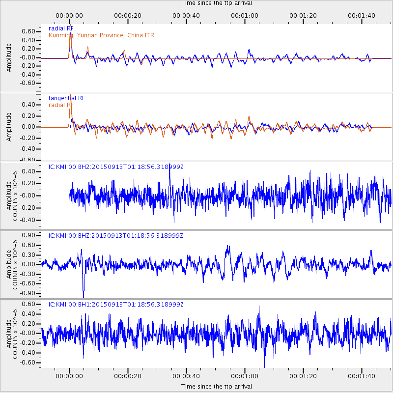
KMI Kunming, Yunnan Province, China - Earthquake Result Viewer
*The percent match for this event was below the threshold and hence no stack was calculated.
| Earthquake location: |
Minahassa Peninsula, Sulawesi |
| Earthquake latitude/longitude: |
0.1/123.4 |
| Earthquake time(UTC): |
2015/09/13 (256) 01:13:12 GMT |
| Earthquake Depth: |
123 km |
| Earthquake Magnitude: |
5.8 MB |
| Earthquake Catalog/Contributor: |
NEIC PDE/NEIC COMCAT |
|
| Network: |
IC New China Digital Seismograph Network |
| Station: |
KMI Kunming, Yunnan Province, China |
| Lat/Lon: |
25.12 N/102.74 E |
| Elevation: |
1975 m |
|
| Distance: |
31.9 deg |
| Az: |
322.717 deg |
| Baz: |
138.069 deg |
| Ray Param: |
$rayparam |
*The percent match for this event was below the threshold and hence was not used in the summary stack. |
|
| Radial Match: |
69.29675 % |
| Radial Bump: |
400 |
| Transverse Match: |
57.14544 % |
| Transverse Bump: |
400 |
| SOD ConfigId: |
7422571 |
| Insert Time: |
2019-04-20 18:29:55.267 +0000 |
| GWidth: |
2.5 |
| Max Bumps: |
400 |
| Tol: |
0.001 |
|
Signal To Noise
| Channel | StoN | STA | LTA |
| IC:KMI:00:BHZ:20150913T01:18:56.318999Z | 3.4140263 | 2.703696E-7 | 7.9193775E-8 |
| IC:KMI:00:BH1:20150913T01:18:56.318999Z | 1.1026947 | 1.2846938E-7 | 1.1650494E-7 |
| IC:KMI:00:BH2:20150913T01:18:56.318999Z | 1.529409 | 1.5428476E-7 | 1.0087868E-7 |
| Arrivals |
| Ps | |
| PpPs | |
| PsPs/PpSs | |


