You are here: Home > Network List > KN - Kyrgyz Seismic Telemetry Network Stations List
> Station TKM2 - > Earthquake Result Viewer
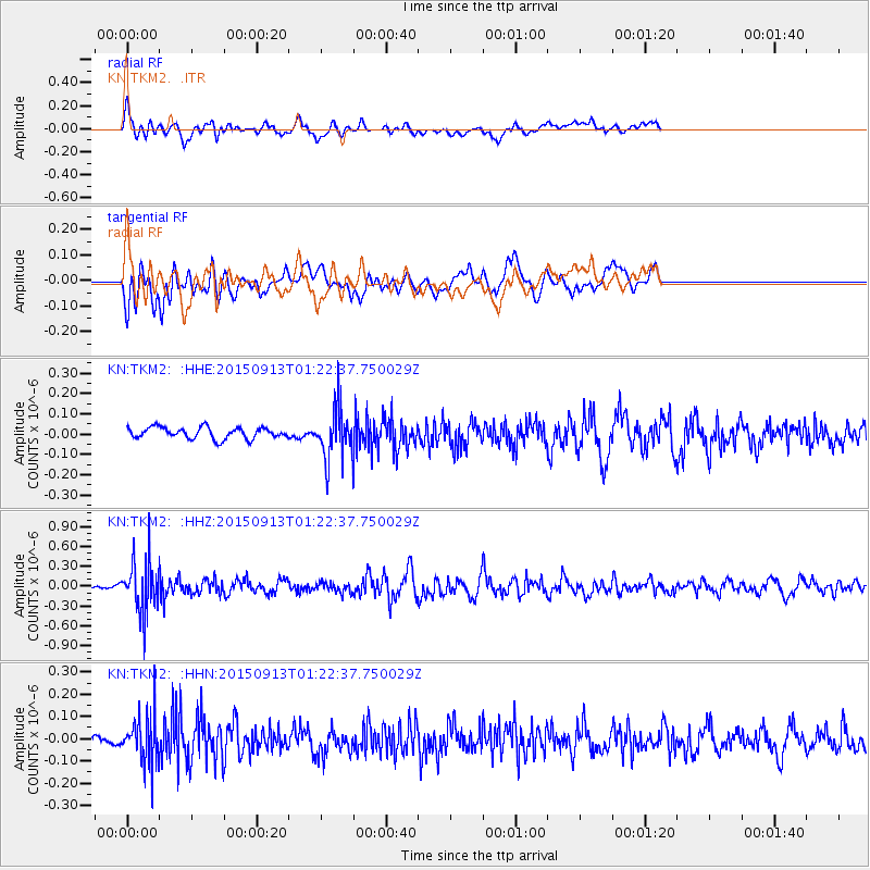
TKM2 - - Earthquake Result Viewer
*The percent match for this event was below the threshold and hence no stack was calculated.
| Earthquake location: |
Minahassa Peninsula, Sulawesi |
| Earthquake latitude/longitude: |
0.1/123.4 |
| Earthquake time(UTC): |
2015/09/13 (256) 01:13:12 GMT |
| Earthquake Depth: |
123 km |
| Earthquake Magnitude: |
5.8 MB |
| Earthquake Catalog/Contributor: |
NEIC PDE/NEIC COMCAT |
|
| Network: |
KN Kyrgyz Seismic Telemetry Network |
| Station: |
TKM2 - |
| Lat/Lon: |
42.92 N/75.60 E |
| Elevation: |
2020 m |
|
| Distance: |
60.3 deg |
| Az: |
321.218 deg |
| Baz: |
121.496 deg |
| Ray Param: |
$rayparam |
*The percent match for this event was below the threshold and hence was not used in the summary stack. |
|
| Radial Match: |
74.19738 % |
| Radial Bump: |
400 |
| Transverse Match: |
65.100204 % |
| Transverse Bump: |
400 |
| SOD ConfigId: |
7422571 |
| Insert Time: |
2019-04-20 18:30:11.322 +0000 |
| GWidth: |
2.5 |
| Max Bumps: |
400 |
| Tol: |
0.001 |
|
Signal To Noise
| Channel | StoN | STA | LTA |
| KN:TKM2: :HHZ:20150913T01:22:37.750029Z | 7.627964 | 3.8608346E-7 | 5.0614222E-8 |
| KN:TKM2: :HHN:20150913T01:22:37.750029Z | 4.6868687 | 1.0768165E-7 | 2.297518E-8 |
| KN:TKM2: :HHE:20150913T01:22:37.750029Z | 4.460292 | 1.2271057E-7 | 2.7511781E-8 |
| Arrivals |
| Ps | |
| PpPs | |
| PsPs/PpSs | |


