You are here: Home > Network List > CN - Canadian National Seismograph Network Stations List
> Station INK INUVIK, NT > Earthquake Result Viewer
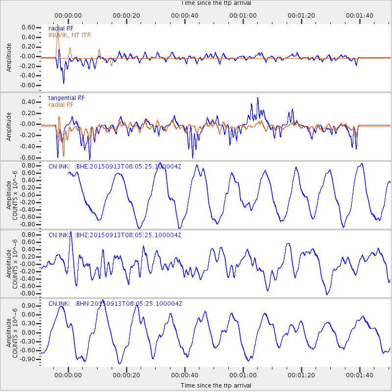
INK INUVIK, NT - Earthquake Result Viewer
*The percent match for this event was below the threshold and hence no stack was calculated.
| Earthquake location: |
Gulf Of California |
| Earthquake latitude/longitude: |
25.1/-109.2 |
| Earthquake time(UTC): |
2015/09/13 (256) 07:57:38 GMT |
| Earthquake Depth: |
10 km |
| Earthquake Magnitude: |
5.6 MWW, 5.5 MWB, 5.6 MWC |
| Earthquake Catalog/Contributor: |
NEIC PDE/NEIC COMCAT |
|
| Network: |
CN Canadian National Seismograph Network |
| Station: |
INK INUVIK, NT |
| Lat/Lon: |
68.31 N/133.53 W |
| Elevation: |
44 m |
|
| Distance: |
45.6 deg |
| Az: |
347.628 deg |
| Baz: |
148.509 deg |
| Ray Param: |
$rayparam |
*The percent match for this event was below the threshold and hence was not used in the summary stack. |
|
| Radial Match: |
43.44109 % |
| Radial Bump: |
400 |
| Transverse Match: |
33.656116 % |
| Transverse Bump: |
247 |
| SOD ConfigId: |
7422571 |
| Insert Time: |
2019-04-20 18:34:28.610 +0000 |
| GWidth: |
2.5 |
| Max Bumps: |
400 |
| Tol: |
0.001 |
|
Signal To Noise
| Channel | StoN | STA | LTA |
| CN:INK: :BHZ:20150913T08:05:25.100004Z | 3.832186 | 4.1913447E-7 | 1.0937216E-7 |
| CN:INK: :BHN:20150913T08:05:25.100004Z | 1.3786212 | 5.3766144E-7 | 3.899994E-7 |
| CN:INK: :BHE:20150913T08:05:25.100004Z | 1.2020911 | 5.289414E-7 | 4.4001777E-7 |
| Arrivals |
| Ps | |
| PpPs | |
| PsPs/PpSs | |


