You are here: Home > Network List > TA - USArray Transportable Network (new EarthScope stations) Stations List
> Station J26L Joseph Creek, AK, USA > Earthquake Result Viewer
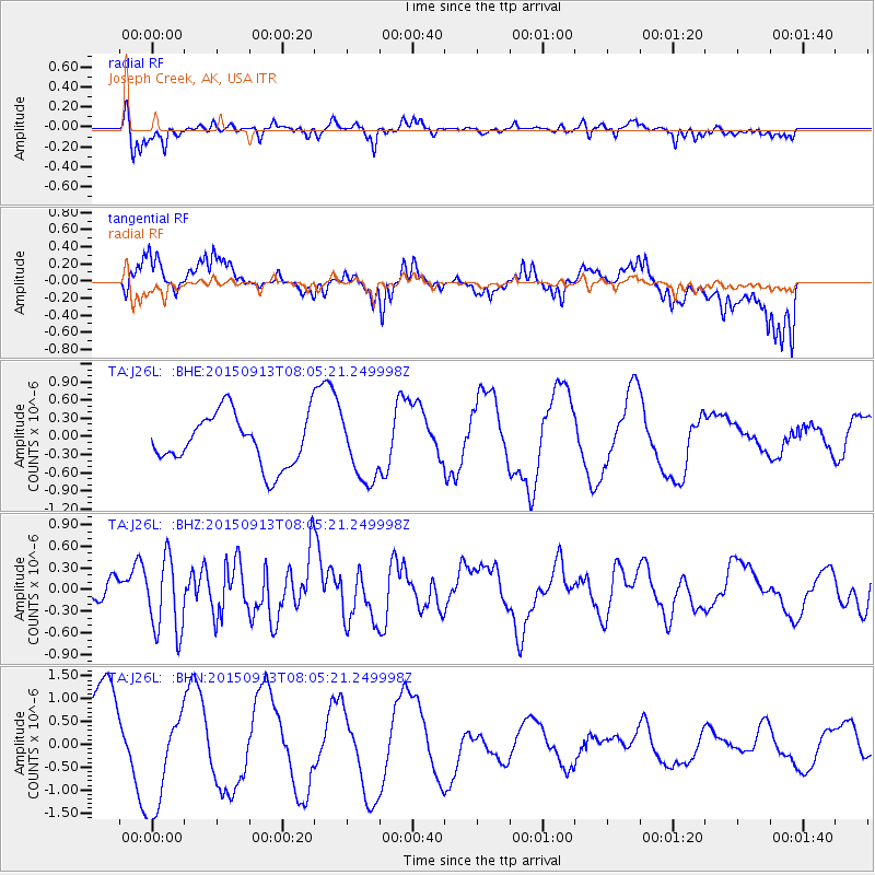
J26L Joseph Creek, AK, USA - Earthquake Result Viewer
*The percent match for this event was below the threshold and hence no stack was calculated.
| Earthquake location: |
Gulf Of California |
| Earthquake latitude/longitude: |
25.1/-109.2 |
| Earthquake time(UTC): |
2015/09/13 (256) 07:57:38 GMT |
| Earthquake Depth: |
10 km |
| Earthquake Magnitude: |
5.6 MWW, 5.5 MWB, 5.6 MWC |
| Earthquake Catalog/Contributor: |
NEIC PDE/NEIC COMCAT |
|
| Network: |
TA USArray Transportable Network (new EarthScope stations) |
| Station: |
J26L Joseph Creek, AK, USA |
| Lat/Lon: |
64.50 N/143.56 W |
| Elevation: |
1144 m |
|
| Distance: |
45.2 deg |
| Az: |
339.856 deg |
| Baz: |
133.852 deg |
| Ray Param: |
$rayparam |
*The percent match for this event was below the threshold and hence was not used in the summary stack. |
|
| Radial Match: |
55.130997 % |
| Radial Bump: |
388 |
| Transverse Match: |
28.640257 % |
| Transverse Bump: |
400 |
| SOD ConfigId: |
7422571 |
| Insert Time: |
2019-04-20 18:36:32.292 +0000 |
| GWidth: |
2.5 |
| Max Bumps: |
400 |
| Tol: |
0.001 |
|
Signal To Noise
| Channel | StoN | STA | LTA |
| TA:J26L: :BHZ:20150913T08:05:21.249998Z | 3.5637393 | 5.196169E-7 | 1.4580665E-7 |
| TA:J26L: :BHN:20150913T08:05:21.249998Z | 1.5554379 | 1.1603996E-6 | 7.4602764E-7 |
| TA:J26L: :BHE:20150913T08:05:21.249998Z | 1.3326874 | 6.913207E-7 | 5.187418E-7 |
| Arrivals |
| Ps | |
| PpPs | |
| PsPs/PpSs | |


