MAKZ Makanchi, Kazakhstan - Earthquake Result Viewer
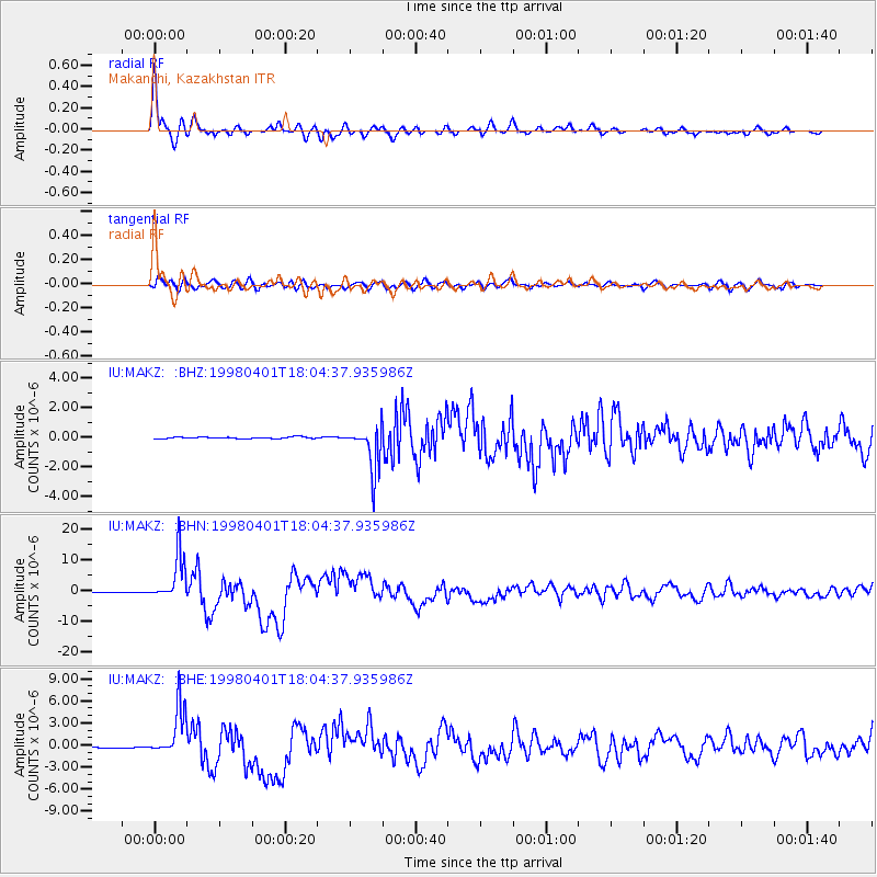
Earthquake location: Southern Sumatra, Indonesia
Earthquake latitude/longitude: -0.5/99.3
Earthquake time(UTC): 1998/04/01 (091) 17:56:23 GMT
Earthquake Depth: 56 km
Earthquake Magnitude: 6.2 MB, 6.9 MS, 7.0 UNKNOWN, 6.6 ME
Earthquake Catalog/Contributor: WHDF/NEIC
Network: IU Global Seismograph Network (GSN - IRIS/USGS)
Station: MAKZ Makanchi, Kazakhstan
Lat/Lon: 46.81 N/81.98 E
Elevation: 600 m
Distance: 49.5 deg
Az: 344.44 deg
Baz: 157.014 deg
Ray Param: 0.06849026
Estimated Moho Depth: 47.5 km
Estimated Crust Vp/Vs: 1.83
Assumed Crust Vp: 6.571 km/s
Estimated Crust Vs: 3.595 km/s
Estimated Crust Poisson's Ratio: 0.29
Radial Match: 96.34483 %
Radial Bump: 399
Transverse Match: 86.44467 %
Transverse Bump: 400
SOD ConfigId: 4480
Insert Time: 2010-03-04 19:33:00.550 +0000
GWidth: 2.5
Max Bumps: 400
Tol: 0.001

Signal To Noise

ChannelStoNSTALTA
IU:MAKZ: :BHN:19980401T18:04:37.935986Z40.2176677.4256263E-61.8463592E-7
IU:MAKZ: :BHE:19980401T18:04:37.935986Z83.288593.3566916E-64.0301938E-8
IU:MAKZ: :BHZ:19980401T18:04:37.935986Z25.4645421.469421E-65.770459E-8
Arrivals
Ps6.3 SECOND
PpPs19 SECOND
PsPs/PpSs26 SECOND