You are here: Home > Network List > TA - USArray Transportable Network (new EarthScope stations) Stations List
> Station L04D Klamath Falls, OR, USA > Earthquake Result Viewer
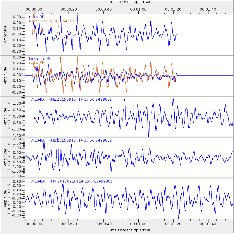
L04D Klamath Falls, OR, USA - Earthquake Result Viewer
*The percent match for this event was below the threshold and hence no stack was calculated.
| Earthquake location: |
New Britain Region, P.N.G. |
| Earthquake latitude/longitude: |
-6.0/151.5 |
| Earthquake time(UTC): |
2015/09/16 (259) 14:03:22 GMT |
| Earthquake Depth: |
6.3 km |
| Earthquake Magnitude: |
6.0 MWB |
| Earthquake Catalog/Contributor: |
NEIC PDE/NEIC COMCAT |
|
| Network: |
TA USArray Transportable Network (new EarthScope stations) |
| Station: |
L04D Klamath Falls, OR, USA |
| Lat/Lon: |
42.22 N/122.30 W |
| Elevation: |
1437 m |
|
| Distance: |
91.2 deg |
| Az: |
47.851 deg |
| Baz: |
263.061 deg |
| Ray Param: |
$rayparam |
*The percent match for this event was below the threshold and hence was not used in the summary stack. |
|
| Radial Match: |
71.55501 % |
| Radial Bump: |
305 |
| Transverse Match: |
52.180218 % |
| Transverse Bump: |
336 |
| SOD ConfigId: |
7422571 |
| Insert Time: |
2019-04-20 18:53:46.987 +0000 |
| GWidth: |
2.5 |
| Max Bumps: |
400 |
| Tol: |
0.001 |
|
Signal To Noise
| Channel | StoN | STA | LTA |
| TA:L04D: :HHZ:20150916T14:15:56.349988Z | 2.7523315 | 4.9814577E-7 | 1.8099047E-7 |
| TA:L04D: :HHN:20150916T14:15:56.349988Z | 0.7876779 | 2.0436475E-7 | 2.5945218E-7 |
| TA:L04D: :HHE:20150916T14:15:56.349988Z | 1.1207074 | 2.7304424E-7 | 2.436356E-7 |
| Arrivals |
| Ps | |
| PpPs | |
| PsPs/PpSs | |


