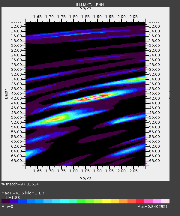
MAKZ Makanchi, Kazakhstan - Earthquake Result Viewer
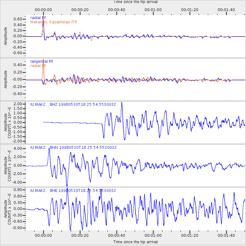
Earthquake location: Off East Coast Of Honshu, Japan
Earthquake latitude/longitude: 39.0/143.4
Earthquake time(UTC): 1998/05/30 (150) 18:18:15 GMT
Earthquake Depth: 33 km
Earthquake Magnitude: 5.7 MB, 5.7 MS, 6.2 UNKNOWN, 6.0 MW
Earthquake Catalog/Contributor: WHDF/NEIC
Network: IU Global Seismograph Network (GSN - IRIS/USGS)
Station: MAKZ Makanchi, Kazakhstan
Lat/Lon: 46.81 N/81.98 E
Elevation: 600 m
Distance: 44.7 deg
Az: 300.841 deg
Baz: 76.812 deg
Ray Param: 0.07171992
Estimated Moho Depth: 41.5 km
Estimated Crust Vp/Vs: 1.88
Assumed Crust Vp: 6.571 km/s
Estimated Crust Vs: 3.495 km/s
Estimated Crust Poisson's Ratio: 0.30
Radial Match: 97.01624 %
Radial Bump: 400
Transverse Match: 86.284424 %
Transverse Bump: 400
SOD ConfigId: 4480
Insert Time: 2010-03-04 19:34:04.625 +0000
GWidth: 2.5
Max Bumps: 400
Tol: 0.001

Signal To Noise

ChannelStoNSTALTA
IU:MAKZ: :BHN:19980530T18:25:54.553003Z59.781491.6172307E-62.7052366E-8
IU:MAKZ: :BHE:19980530T18:25:54.553003Z13.0625933.1381575E-72.4024E-8
IU:MAKZ: :BHZ:19980530T18:25:54.553003Z19.2910946.399914E-73.317549E-8
Arrivals
Ps5.9 SECOND
PpPs17 SECOND
PsPs/PpSs23 SECOND