MAKZ Makanchi, Kazakhstan - Earthquake Result Viewer
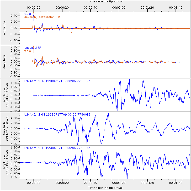
Earthquake location: Near N Coast Of New Guinea, P.N.G.
Earthquake latitude/longitude: -3.0/141.9
Earthquake time(UTC): 1998/07/17 (198) 08:49:13 GMT
Earthquake Depth: 10 km
Earthquake Magnitude: 5.8 MB, 7.1 MS, 7.1 UNKNOWN, 6.4 ME
Earthquake Catalog/Contributor: WHDF/NEIC
Network: IU Global Seismograph Network (GSN - IRIS/USGS)
Station: MAKZ Makanchi, Kazakhstan
Lat/Lon: 46.81 N/81.98 E
Elevation: 600 m
Distance: 72.2 deg
Az: 321.35 deg
Baz: 114.761 deg
Ray Param: 0.053840373
Estimated Moho Depth: 38.0 km
Estimated Crust Vp/Vs: 2.02
Assumed Crust Vp: 6.571 km/s
Estimated Crust Vs: 3.261 km/s
Estimated Crust Poisson's Ratio: 0.34
Radial Match: 98.12037 %
Radial Bump: 400
Transverse Match: 91.543106 %
Transverse Bump: 400
SOD ConfigId: 4480
Insert Time: 2010-03-04 19:34:20.652 +0000
GWidth: 2.5
Max Bumps: 400
Tol: 0.001

Signal To Noise

ChannelStoNSTALTA
IU:MAKZ: :BHN:19980717T09:00:06.778003Z2.98824078.802436E-82.9456917E-8
IU:MAKZ: :BHE:19980717T09:00:06.778003Z1.44181313.323565E-82.305129E-8
IU:MAKZ: :BHZ:19980717T09:00:06.778003Z2.05013754.305239E-82.0999755E-8
Arrivals
Ps6.1 SECOND
PpPs17 SECOND
PsPs/PpSs23 SECOND