MAKZ Makanchi, Kazakhstan - Earthquake Result Viewer
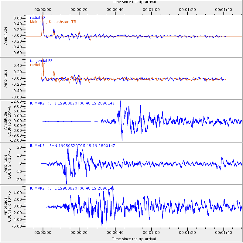
Earthquake location: Bonin Islands, Japan Region
Earthquake latitude/longitude: 28.9/139.3
Earthquake time(UTC): 1998/08/20 (232) 06:40:55 GMT
Earthquake Depth: 441 km
Earthquake Magnitude: 6.1 MB, 7.0 UNKNOWN, 7.0 MW
Earthquake Catalog/Contributor: WHDF/NEIC
Network: IU Global Seismograph Network (GSN - IRIS/USGS)
Station: MAKZ Makanchi, Kazakhstan
Lat/Lon: 46.81 N/81.98 E
Elevation: 600 m
Distance: 47.6 deg
Az: 308.419 deg
Baz: 91.016 deg
Ray Param: 0.06798107
Estimated Moho Depth: 44.0 km
Estimated Crust Vp/Vs: 1.85
Assumed Crust Vp: 6.571 km/s
Estimated Crust Vs: 3.561 km/s
Estimated Crust Poisson's Ratio: 0.29
Radial Match: 96.941666 %
Radial Bump: 325
Transverse Match: 89.47477 %
Transverse Bump: 400
SOD ConfigId: 4480
Insert Time: 2010-03-04 19:34:29.701 +0000
GWidth: 2.5
Max Bumps: 400
Tol: 0.001

Signal To Noise

ChannelStoNSTALTA
IU:MAKZ: :BHN:19980820T06:48:19.289014Z9.5531328.4123195E-78.805823E-8
IU:MAKZ: :BHE:19980820T06:48:19.289014Z2.7121956.0146384E-82.2176277E-8
IU:MAKZ: :BHZ:19980820T06:48:19.289014Z7.7422033.8759703E-75.0062884E-8
Arrivals
Ps6.0 SECOND
PpPs18 SECOND
PsPs/PpSs24 SECOND