
MAKZ Makanchi, Kazakhstan - Earthquake Result Viewer
| ||||||||||||||||||
| ||||||||||||||||||
| ||||||||||||||||||
|
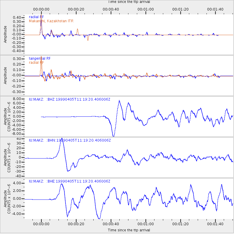
Signal To Noise
| Channel | StoN | STA | LTA |
| IU:MAKZ: :BHN:19990405T11:19:20.406006Z | 2.6665518 | 8.227621E-7 | 3.0854906E-7 |
| IU:MAKZ: :BHE:19990405T11:19:20.406006Z | 1.8073335 | 9.117674E-8 | 5.0448207E-8 |
| IU:MAKZ: :BHZ:19990405T11:19:20.406006Z | 2.3327725 | 1.4512808E-7 | 6.22127E-8 |
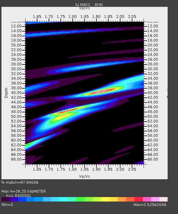
| Arrivals | |
| Ps | 5.7 SECOND |
| PpPs | 17 SECOND |
| PsPs/PpSs | 23 SECOND |

