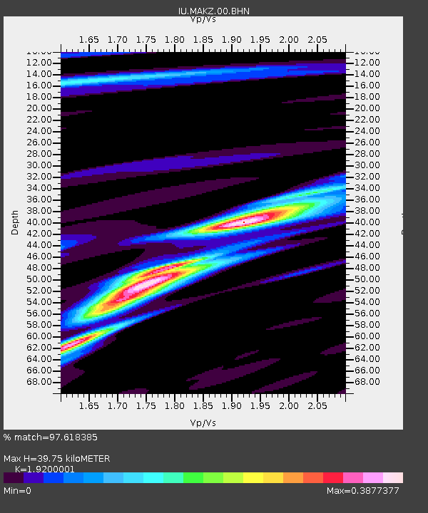
MAKZ Makanchi, Kazakhstan - Earthquake Result Viewer
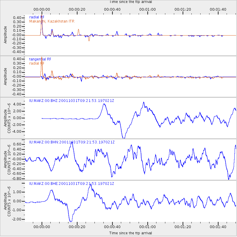
Earthquake location: New Britain Region, P.N.G.
Earthquake latitude/longitude: -5.9/150.2
Earthquake time(UTC): 2001/10/31 (304) 09:10:20 GMT
Earthquake Depth: 33 km
Earthquake Magnitude: 5.9 MB, 6.9 MS, 6.9 MW, 6.9 MW
Earthquake Catalog/Contributor: WHDF/NEIC
Network: IU Global Seismograph Network (GSN - IRIS/USGS)
Station: MAKZ Makanchi, Kazakhstan
Lat/Lon: 46.81 N/81.98 E
Elevation: 600 m
Distance: 79.7 deg
Az: 319.583 deg
Baz: 110.127 deg
Ray Param: 0.048750885
Estimated Moho Depth: 39.75 km
Estimated Crust Vp/Vs: 1.92
Assumed Crust Vp: 6.571 km/s
Estimated Crust Vs: 3.422 km/s
Estimated Crust Poisson's Ratio: 0.31
Radial Match: 97.618385 %
Radial Bump: 264
Transverse Match: 91.49627 %
Transverse Bump: 400
SOD ConfigId: 20082
Insert Time: 2010-03-04 19:36:25.417 +0000
GWidth: 2.5
Max Bumps: 400
Tol: 0.001

Signal To Noise

ChannelStoNSTALTA
IU:MAKZ:00:BHN:20011031T09:21:53.197021Z2.79709721.5289683E-75.466268E-8
IU:MAKZ:00:BHE:20011031T09:21:53.197021Z8.9727584.3733507E-74.8740315E-8
IU:MAKZ:00:BHZ:20011031T09:21:53.197021Z19.8635271.4361048E-67.2298576E-8
Arrivals
Ps5.7 SECOND
PpPs17 SECOND
PsPs/PpSs23 SECOND