You are here: Home > Network List > CI - Caltech Regional Seismic Network Stations List
> Station TIN Tinemaha, Big Pine, CA, USA > Earthquake Result Viewer
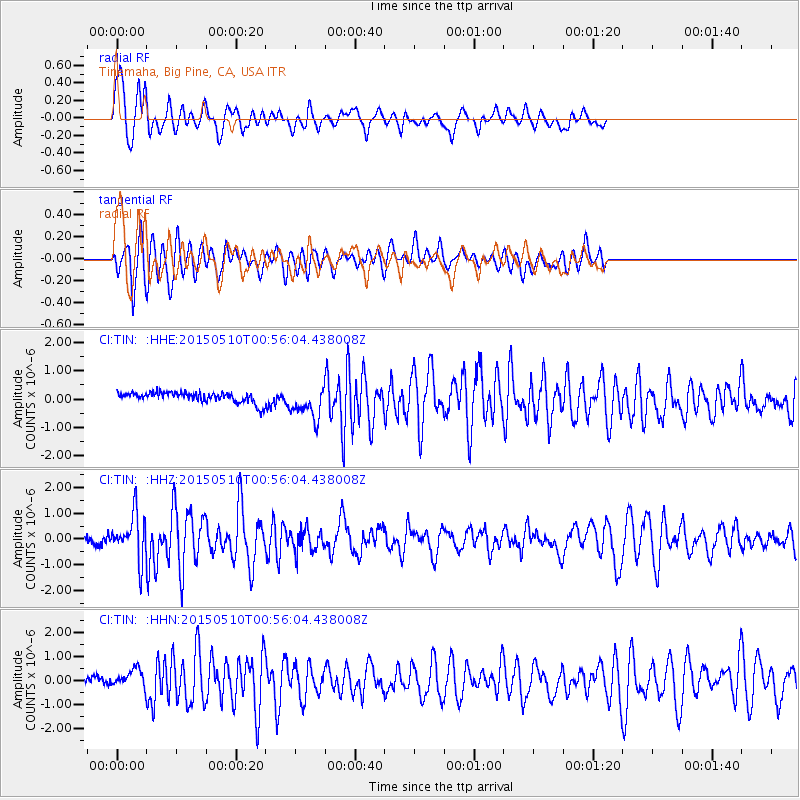
TIN Tinemaha, Big Pine, CA, USA - Earthquake Result Viewer
*The percent match for this event was below the threshold and hence no stack was calculated.
| Earthquake location: |
Near Coast Of Chiapas, Mexico |
| Earthquake latitude/longitude: |
14.9/-94.0 |
| Earthquake time(UTC): |
2015/05/10 (130) 00:50:18 GMT |
| Earthquake Depth: |
6.7 km |
| Earthquake Magnitude: |
5.6 MB |
| Earthquake Catalog/Contributor: |
NEIC PDE/NEIC COMCAT |
|
| Network: |
CI Caltech Regional Seismic Network |
| Station: |
TIN Tinemaha, Big Pine, CA, USA |
| Lat/Lon: |
37.05 N/118.23 W |
| Elevation: |
1197 m |
|
| Distance: |
30.9 deg |
| Az: |
320.198 deg |
| Baz: |
129.31 deg |
| Ray Param: |
$rayparam |
*The percent match for this event was below the threshold and hence was not used in the summary stack. |
|
| Radial Match: |
75.04266 % |
| Radial Bump: |
400 |
| Transverse Match: |
76.95887 % |
| Transverse Bump: |
400 |
| SOD ConfigId: |
976571 |
| Insert Time: |
2015-05-24 01:04:16.871 +0000 |
| GWidth: |
2.5 |
| Max Bumps: |
400 |
| Tol: |
0.001 |
|
Signal To Noise
| Channel | StoN | STA | LTA |
| CI:TIN: :HHZ:20150510T00:56:04.438008Z | 6.306398 | 8.7589916E-7 | 1.3889056E-7 |
| CI:TIN: :HHN:20150510T00:56:04.438008Z | 2.2817557 | 3.8430133E-7 | 1.6842351E-7 |
| CI:TIN: :HHE:20150510T00:56:04.438008Z | 3.1587381 | 5.736275E-7 | 1.8160021E-7 |
| Arrivals |
| Ps | |
| PpPs | |
| PsPs/PpSs | |


