You are here: Home > Network List > IU - Global Seismograph Network (GSN - IRIS/USGS) Stations List
> Station MAKZ Makanchi, Kazakhstan > Earthquake Result Viewer
MAKZ Makanchi, Kazakhstan - Earthquake Result Viewer
*The percent match for this event was below the threshold and hence no stack was calculated.
| Earthquake location: |
Kuril Islands |
| Earthquake latitude/longitude: |
45.9/149.1 |
| Earthquake time(UTC): |
1998/08/18 (230) 18:00:12 GMT |
| Earthquake Depth: |
116 km |
| Earthquake Magnitude: |
5.6 UNKNOWN, 5.4 MB, 5.6 MW |
| Earthquake Catalog/Contributor: |
WHDF/NEIC |
|
| Network: |
IU Global Seismograph Network (GSN - IRIS/USGS) |
| Station: |
MAKZ Makanchi, Kazakhstan |
| Lat/Lon: |
46.81 N/81.98 E |
| Elevation: |
600 m |
|
| Distance: |
45.1 deg |
| Az: |
296.611 deg |
| Baz: |
65.469 deg |
| Ray Param: |
$rayparam |
*The percent match for this event was below the threshold and hence was not used in the summary stack. |
|
| Radial Match: |
62.077835 % |
| Radial Bump: |
343 |
| Transverse Match: |
54.59118 % |
| Transverse Bump: |
400 |
| SOD ConfigId: |
4480 |
| Insert Time: |
2010-03-04 19:38:53.526 +0000 |
| GWidth: |
2.5 |
| Max Bumps: |
400 |
| Tol: |
0.001 |
|
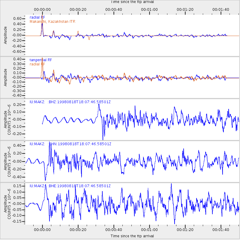
Signal To Noise
| Channel | StoN | STA | LTA |
| IU:MAKZ: :BHN:19980818T18:07:46.58501Z | 5.671621 | 2.2467889E-7 | 3.9614584E-8 |
| IU:MAKZ: :BHE:19980818T18:07:46.58501Z | 3.2229285 | 7.8000106E-8 | 2.4201624E-8 |
| IU:MAKZ: :BHZ:19980818T18:07:46.58501Z | 4.564732 | 1.1558296E-7 | 2.5320864E-8 |
| Arrivals |
| Ps | |
| PpPs | |
| PsPs/PpSs | |


