You are here: Home > Network List > IU - Global Seismograph Network (GSN - IRIS/USGS) Stations List
> Station MAKZ Makanchi, Kazakhstan > Earthquake Result Viewer
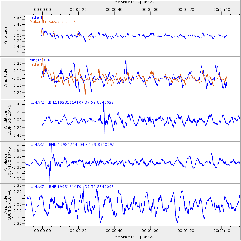
MAKZ Makanchi, Kazakhstan - Earthquake Result Viewer
*The percent match for this event was below the threshold and hence no stack was calculated.
| Earthquake location: |
Southeast Of Honshu, Japan |
| Earthquake latitude/longitude: |
30.9/137.7 |
| Earthquake time(UTC): |
1998/12/14 (348) 04:30:56 GMT |
| Earthquake Depth: |
464 km |
| Earthquake Magnitude: |
5.5 UNKNOWN, 4.9 MB |
| Earthquake Catalog/Contributor: |
WHDF/NEIC |
|
| Network: |
IU Global Seismograph Network (GSN - IRIS/USGS) |
| Station: |
MAKZ Makanchi, Kazakhstan |
| Lat/Lon: |
46.81 N/81.98 E |
| Elevation: |
600 m |
|
| Distance: |
45.2 deg |
| Az: |
306.938 deg |
| Baz: |
90.075 deg |
| Ray Param: |
$rayparam |
*The percent match for this event was below the threshold and hence was not used in the summary stack. |
|
| Radial Match: |
60.68671 % |
| Radial Bump: |
400 |
| Transverse Match: |
66.57433 % |
| Transverse Bump: |
400 |
| SOD ConfigId: |
4480 |
| Insert Time: |
2010-03-04 19:39:17.596 +0000 |
| GWidth: |
2.5 |
| Max Bumps: |
400 |
| Tol: |
0.001 |
|
Signal To Noise
| Channel | StoN | STA | LTA |
| IU:MAKZ: :BHN:19981214T04:37:59.834009Z | 2.4612706 | 2.950826E-7 | 1.1989034E-7 |
| IU:MAKZ: :BHE:19981214T04:37:59.834009Z | 1.7038751 | 1.0981685E-7 | 6.4451235E-8 |
| IU:MAKZ: :BHZ:19981214T04:37:59.834009Z | 2.1558795 | 1.2227963E-7 | 5.6719134E-8 |
| Arrivals |
| Ps | |
| PpPs | |
| PsPs/PpSs | |


