You are here: Home > Network List > TA - USArray Transportable Network (new EarthScope stations) Stations List
> Station P60A Greenville, DE, USA > Earthquake Result Viewer
P60A Greenville, DE, USA - Earthquake Result Viewer
*The percent match for this event was below the threshold and hence no stack was calculated.
| Earthquake location: |
Near Coast Of Central Chile |
| Earthquake latitude/longitude: |
-31.8/-71.6 |
| Earthquake time(UTC): |
2015/09/16 (259) 23:03:56 GMT |
| Earthquake Depth: |
10 km |
| Earthquake Magnitude: |
6.1 MB |
| Earthquake Catalog/Contributor: |
NEIC PDE/NEIC COMCAT |
|
| Network: |
TA USArray Transportable Network (new EarthScope stations) |
| Station: |
P60A Greenville, DE, USA |
| Lat/Lon: |
39.81 N/75.64 W |
| Elevation: |
105 m |
|
| Distance: |
71.4 deg |
| Az: |
356.693 deg |
| Baz: |
176.346 deg |
| Ray Param: |
$rayparam |
*The percent match for this event was below the threshold and hence was not used in the summary stack. |
|
| Radial Match: |
50.46652 % |
| Radial Bump: |
244 |
| Transverse Match: |
64.733315 % |
| Transverse Bump: |
211 |
| SOD ConfigId: |
7422571 |
| Insert Time: |
2019-04-20 19:22:05.626 +0000 |
| GWidth: |
2.5 |
| Max Bumps: |
400 |
| Tol: |
0.001 |
|
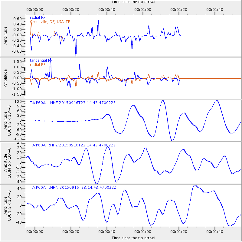
Signal To Noise
| Channel | StoN | STA | LTA |
| TA:P60A: :HHZ:20150916T23:14:43.470022Z | 1.2600785 | 5.7683865E-6 | 4.5777992E-6 |
| TA:P60A: :HHN:20150916T23:14:43.470022Z | 0.7866907 | 4.5075917E-6 | 5.7298143E-6 |
| TA:P60A: :HHE:20150916T23:14:43.470022Z | 6.138342 | 1.19214E-5 | 1.9421207E-6 |
| Arrivals |
| Ps | |
| PpPs | |
| PsPs/PpSs | |


