You are here: Home > Network List > TA - USArray Transportable Network (new EarthScope stations) Stations List
> Station 121A Cookes Peak, Deming, NM, USA > Earthquake Result Viewer
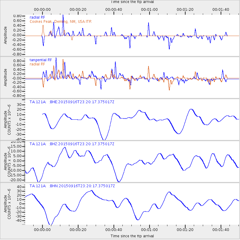
121A Cookes Peak, Deming, NM, USA - Earthquake Result Viewer
*The percent match for this event was below the threshold and hence no stack was calculated.
| Earthquake location: |
Near Coast Of Central Chile |
| Earthquake latitude/longitude: |
-31.5/-71.7 |
| Earthquake time(UTC): |
2015/09/16 (259) 23:09:22 GMT |
| Earthquake Depth: |
10 km |
| Earthquake Magnitude: |
5.6 MB, 5.9 MB |
| Earthquake Catalog/Contributor: |
NEIC PDE/NEIC COMCAT |
|
| Network: |
TA USArray Transportable Network (new EarthScope stations) |
| Station: |
121A Cookes Peak, Deming, NM, USA |
| Lat/Lon: |
32.53 N/107.79 W |
| Elevation: |
1652 m |
|
| Distance: |
72.3 deg |
| Az: |
328.486 deg |
| Baz: |
148.094 deg |
| Ray Param: |
$rayparam |
*The percent match for this event was below the threshold and hence was not used in the summary stack. |
|
| Radial Match: |
75.49957 % |
| Radial Bump: |
217 |
| Transverse Match: |
83.746086 % |
| Transverse Bump: |
371 |
| SOD ConfigId: |
7422571 |
| Insert Time: |
2019-04-20 19:36:03.977 +0000 |
| GWidth: |
2.5 |
| Max Bumps: |
400 |
| Tol: |
0.001 |
|
Signal To Noise
| Channel | StoN | STA | LTA |
| TA:121A: :BHZ:20150916T23:20:17.375017Z | 1.0312948 | 1.0758494E-5 | 1.0432025E-5 |
| TA:121A: :BHN:20150916T23:20:17.375017Z | 2.7314036 | 3.7870504E-5 | 1.3864852E-5 |
| TA:121A: :BHE:20150916T23:20:17.375017Z | 2.57147 | 2.2482782E-5 | 8.743164E-6 |
| Arrivals |
| Ps | |
| PpPs | |
| PsPs/PpSs | |


