You are here: Home > Network List > TA - USArray Transportable Network (new EarthScope stations) Stations List
> Station M53A WI Miller and Sons, Farmdale, OH, USA > Earthquake Result Viewer
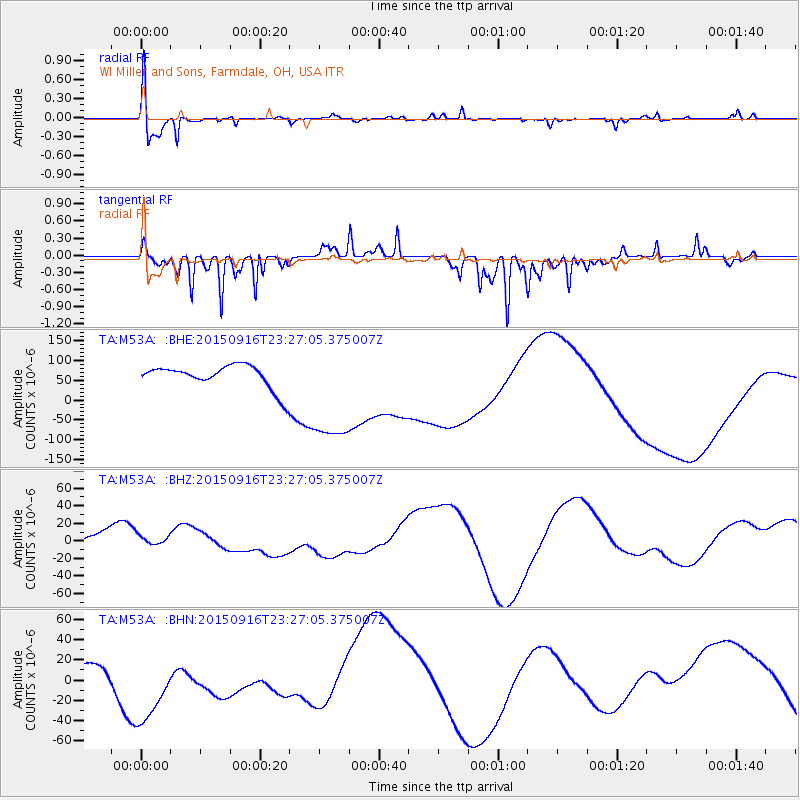
M53A WI Miller and Sons, Farmdale, OH, USA - Earthquake Result Viewer
*The percent match for this event was below the threshold and hence no stack was calculated.
| Earthquake location: |
Near Coast Of Central Chile |
| Earthquake latitude/longitude: |
-31.6/-71.9 |
| Earthquake time(UTC): |
2015/09/16 (259) 23:16:05 GMT |
| Earthquake Depth: |
10 km |
| Earthquake Magnitude: |
6.2 MB |
| Earthquake Catalog/Contributor: |
NEIC PDE/NEIC COMCAT |
|
| Network: |
TA USArray Transportable Network (new EarthScope stations) |
| Station: |
M53A WI Miller and Sons, Farmdale, OH, USA |
| Lat/Lon: |
41.44 N/80.68 W |
| Elevation: |
334 m |
|
| Distance: |
73.1 deg |
| Az: |
353.123 deg |
| Baz: |
172.189 deg |
| Ray Param: |
$rayparam |
*The percent match for this event was below the threshold and hence was not used in the summary stack. |
|
| Radial Match: |
70.09046 % |
| Radial Bump: |
400 |
| Transverse Match: |
78.52949 % |
| Transverse Bump: |
322 |
| SOD ConfigId: |
7422571 |
| Insert Time: |
2019-04-20 19:43:11.336 +0000 |
| GWidth: |
2.5 |
| Max Bumps: |
400 |
| Tol: |
0.001 |
|
Signal To Noise
| Channel | StoN | STA | LTA |
| TA:M53A: :BHZ:20150916T23:27:05.375007Z | 0.8778397 | 8.034774E-6 | 9.152895E-6 |
| TA:M53A: :BHN:20150916T23:27:05.375007Z | 5.8324785 | 4.3863587E-5 | 7.5205744E-6 |
| TA:M53A: :BHE:20150916T23:27:05.375007Z | 5.2687387 | 1.458117E-4 | 2.7674878E-5 |
| Arrivals |
| Ps | |
| PpPs | |
| PsPs/PpSs | |


