You are here: Home > Network List > TA - USArray Transportable Network (new EarthScope stations) Stations List
> Station L04D Klamath Falls, OR, USA > Earthquake Result Viewer
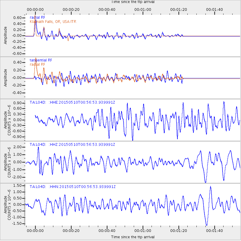
L04D Klamath Falls, OR, USA - Earthquake Result Viewer
*The percent match for this event was below the threshold and hence no stack was calculated.
| Earthquake location: |
Near Coast Of Chiapas, Mexico |
| Earthquake latitude/longitude: |
14.9/-94.0 |
| Earthquake time(UTC): |
2015/05/10 (130) 00:50:18 GMT |
| Earthquake Depth: |
6.7 km |
| Earthquake Magnitude: |
5.6 MB |
| Earthquake Catalog/Contributor: |
NEIC PDE/NEIC COMCAT |
|
| Network: |
TA USArray Transportable Network (new EarthScope stations) |
| Station: |
L04D Klamath Falls, OR, USA |
| Lat/Lon: |
42.22 N/122.30 W |
| Elevation: |
1437 m |
|
| Distance: |
36.6 deg |
| Az: |
323.756 deg |
| Baz: |
129.682 deg |
| Ray Param: |
$rayparam |
*The percent match for this event was below the threshold and hence was not used in the summary stack. |
|
| Radial Match: |
78.63666 % |
| Radial Bump: |
400 |
| Transverse Match: |
62.375355 % |
| Transverse Bump: |
400 |
| SOD ConfigId: |
976571 |
| Insert Time: |
2015-05-24 01:29:38.150 +0000 |
| GWidth: |
2.5 |
| Max Bumps: |
400 |
| Tol: |
0.001 |
|
Signal To Noise
| Channel | StoN | STA | LTA |
| TA:L04D: :HHZ:20150510T00:56:53.939991Z | 8.932111 | 9.80846E-7 | 1.0981123E-7 |
| TA:L04D: :HHN:20150510T00:56:53.939991Z | 2.3184123 | 3.6110575E-7 | 1.5575563E-7 |
| TA:L04D: :HHE:20150510T00:56:53.939991Z | 1.5799856 | 2.5850989E-7 | 1.6361534E-7 |
| Arrivals |
| Ps | |
| PpPs | |
| PsPs/PpSs | |


