
TUC Tucson, Arizona - Earthquake Result Viewer
| ||||||||||||||||||
| ||||||||||||||||||
| ||||||||||||||||||
|
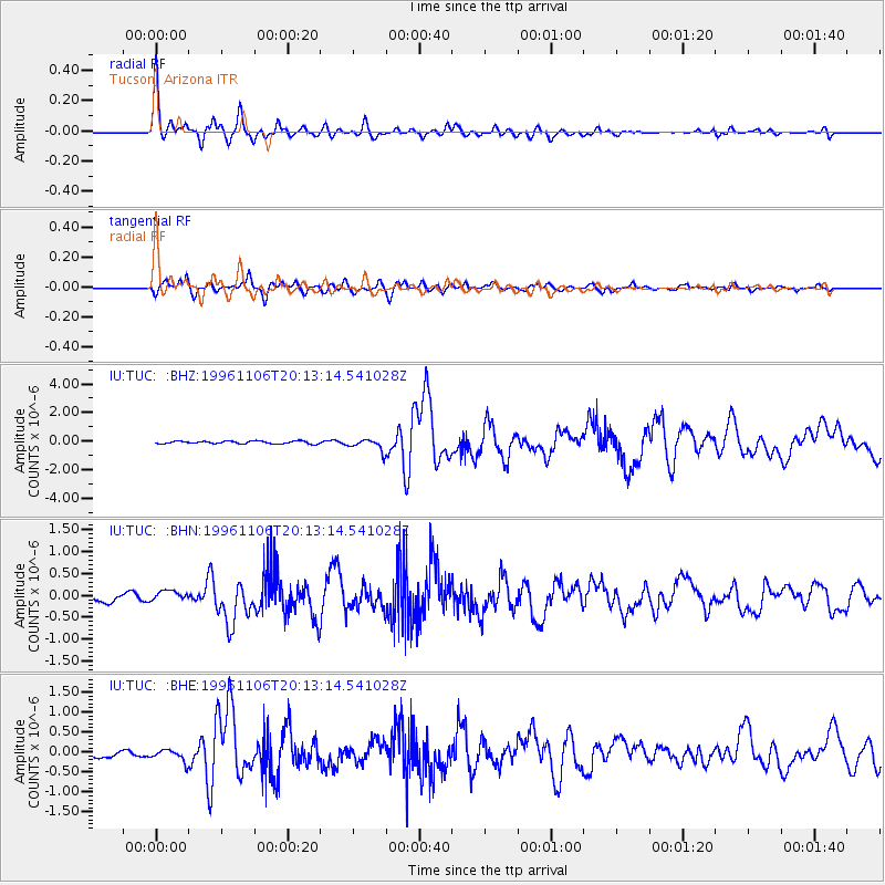
Signal To Noise
| Channel | StoN | STA | LTA |
| IU:TUC: :BHN:19961106T20:13:14.541028Z | 0.99287015 | 1.1919248E-7 | 1.2004841E-7 |
| IU:TUC: :BHE:19961106T20:13:14.541028Z | 1.0988466 | 1.5652405E-7 | 1.4244397E-7 |
| IU:TUC: :BHZ:19961106T20:13:14.541028Z | 4.5499487 | 4.11692E-7 | 9.0482786E-8 |
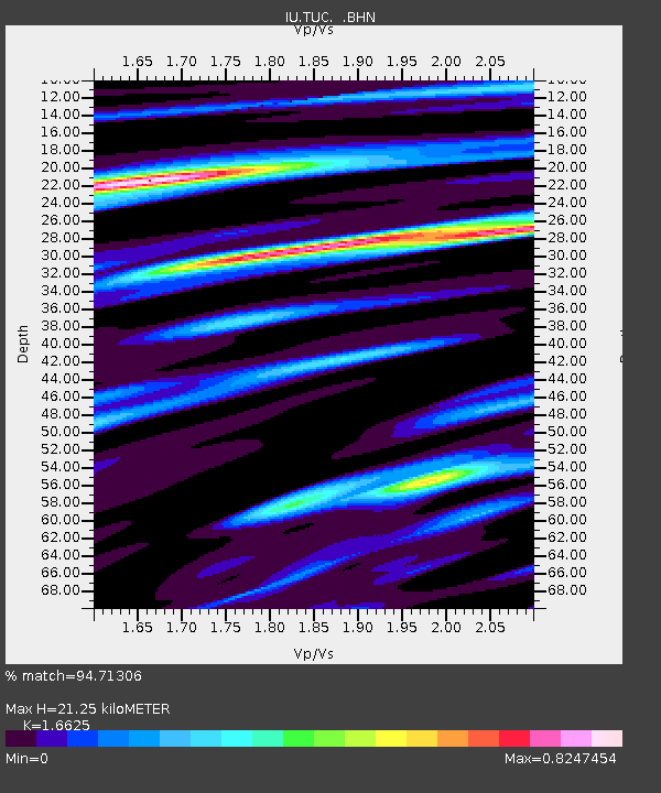
| Arrivals | |
| Ps | 2.3 SECOND |
| PpPs | 8.8 SECOND |
| PsPs/PpSs | 11 SECOND |

