TUC Tucson, Arizona - Earthquake Result Viewer
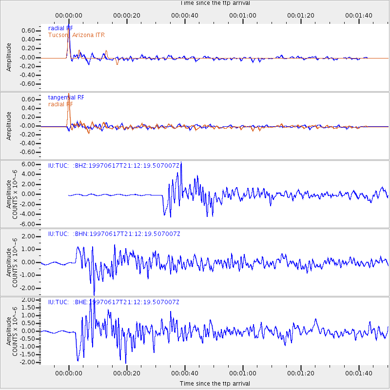
Earthquake location: Andreanof Islands, Aleutian Is.
Earthquake latitude/longitude: 51.3/-179.3
Earthquake time(UTC): 1997/06/17 (168) 21:03:40 GMT
Earthquake Depth: 33 km
Earthquake Magnitude: 6.4 MB, 6.3 MS, 6.4 UNKNOWN, 6.6 ML
Earthquake Catalog/Contributor: WHDF/NEIC
Network: IU Global Seismograph Network (GSN - IRIS/USGS)
Station: TUC Tucson, Arizona
Lat/Lon: 32.31 N/110.78 W
Elevation: 874 m
Distance: 52.5 deg
Az: 83.314 deg
Baz: 312.642 deg
Ray Param: 0.06664929
Estimated Moho Depth: 11.25 km
Estimated Crust Vp/Vs: 2.02
Assumed Crust Vp: 6.276 km/s
Estimated Crust Vs: 3.103 km/s
Estimated Crust Poisson's Ratio: 0.34
Radial Match: 96.54654 %
Radial Bump: 316
Transverse Match: 85.91177 %
Transverse Bump: 400
SOD ConfigId: 6273
Insert Time: 2010-03-04 19:45:46.558 +0000
GWidth: 2.5
Max Bumps: 400
Tol: 0.001

Signal To Noise

ChannelStoNSTALTA
IU:TUC: :BHN:19970617T21:12:19.507007Z12.2430435.410838E-74.4195207E-8
IU:TUC: :BHE:19970617T21:12:19.507007Z20.2738677.766834E-73.8309583E-8
IU:TUC: :BHZ:19970617T21:12:19.507007Z17.0961591.6903634E-69.8873876E-8
Arrivals
Ps1.9 SECOND
PpPs5.2 SECOND
PsPs/PpSs7.1 SECOND