You are here: Home > Network List > TA - USArray Transportable Network (new EarthScope stations) Stations List
> Station M54A Oil Creek State Park, Oil City, PA, USA > Earthquake Result Viewer
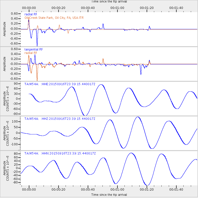
M54A Oil Creek State Park, Oil City, PA, USA - Earthquake Result Viewer
*The percent match for this event was below the threshold and hence no stack was calculated.
| Earthquake location: |
Near Coast Of Central Chile |
| Earthquake latitude/longitude: |
-30.7/-71.8 |
| Earthquake time(UTC): |
2015/09/16 (259) 23:28:23 GMT |
| Earthquake Depth: |
21 km |
| Earthquake Magnitude: |
5.5 MB |
| Earthquake Catalog/Contributor: |
NEIC PDE/NEIC COMCAT |
|
| Network: |
TA USArray Transportable Network (new EarthScope stations) |
| Station: |
M54A Oil Creek State Park, Oil City, PA, USA |
| Lat/Lon: |
41.51 N/79.66 W |
| Elevation: |
488 m |
|
| Distance: |
72.2 deg |
| Az: |
353.808 deg |
| Baz: |
172.895 deg |
| Ray Param: |
$rayparam |
*The percent match for this event was below the threshold and hence was not used in the summary stack. |
|
| Radial Match: |
91.4333 % |
| Radial Bump: |
400 |
| Transverse Match: |
52.473087 % |
| Transverse Bump: |
400 |
| SOD ConfigId: |
7422571 |
| Insert Time: |
2019-04-20 20:04:27.083 +0000 |
| GWidth: |
2.5 |
| Max Bumps: |
400 |
| Tol: |
0.001 |
|
Signal To Noise
| Channel | StoN | STA | LTA |
| TA:M54A: :HHZ:20150916T23:39:15.440017Z | 0.12632649 | 4.807278E-6 | 3.8054393E-5 |
| TA:M54A: :HHN:20150916T23:39:15.440017Z | 0.45769072 | 1.5959085E-5 | 3.486871E-5 |
| TA:M54A: :HHE:20150916T23:39:15.440017Z | 3.3264067 | 5.1228126E-5 | 1.540044E-5 |
| Arrivals |
| Ps | |
| PpPs | |
| PsPs/PpSs | |


