You are here: Home > Network List > UW - Pacific Northwest Regional Seismic Network Stations List
> Station UMAT Pilot Rock, OR, USA > Earthquake Result Viewer
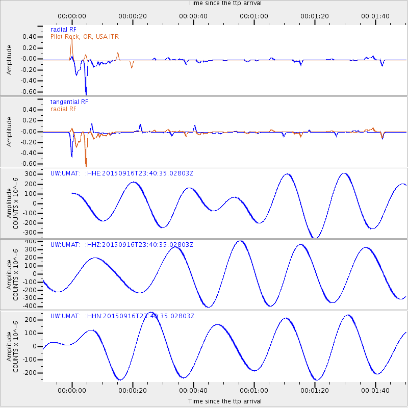
UMAT Pilot Rock, OR, USA - Earthquake Result Viewer
*The percent match for this event was below the threshold and hence no stack was calculated.
| Earthquake location: |
Near Coast Of Central Chile |
| Earthquake latitude/longitude: |
-30.7/-71.8 |
| Earthquake time(UTC): |
2015/09/16 (259) 23:28:23 GMT |
| Earthquake Depth: |
21 km |
| Earthquake Magnitude: |
5.5 MB |
| Earthquake Catalog/Contributor: |
NEIC PDE/NEIC COMCAT |
|
| Network: |
UW Pacific Northwest Regional Seismic Network |
| Station: |
UMAT Pilot Rock, OR, USA |
| Lat/Lon: |
45.29 N/118.96 W |
| Elevation: |
1318 m |
|
| Distance: |
86.9 deg |
| Az: |
328.781 deg |
| Baz: |
140.778 deg |
| Ray Param: |
$rayparam |
*The percent match for this event was below the threshold and hence was not used in the summary stack. |
|
| Radial Match: |
96.94249 % |
| Radial Bump: |
268 |
| Transverse Match: |
30.509628 % |
| Transverse Bump: |
185 |
| SOD ConfigId: |
7422571 |
| Insert Time: |
2019-04-20 20:05:21.423 +0000 |
| GWidth: |
2.5 |
| Max Bumps: |
400 |
| Tol: |
0.001 |
|
Signal To Noise
| Channel | StoN | STA | LTA |
| UW:UMAT: :HHZ:20150916T23:40:35.02803Z | 0.5232678 | 9.110934E-5 | 1.7411607E-4 |
| UW:UMAT: :HHN:20150916T23:40:35.02803Z | 0.61946326 | 6.98987E-5 | 1.12837515E-4 |
| UW:UMAT: :HHE:20150916T23:40:35.02803Z | 1.6083822 | 2.0800621E-4 | 1.2932635E-4 |
| Arrivals |
| Ps | |
| PpPs | |
| PsPs/PpSs | |


