You are here: Home > Network List > TA - USArray Transportable Network (new EarthScope stations) Stations List
> Station L44A Lake County Forest Preserve, Grayslake, IL, USA > Earthquake Result Viewer
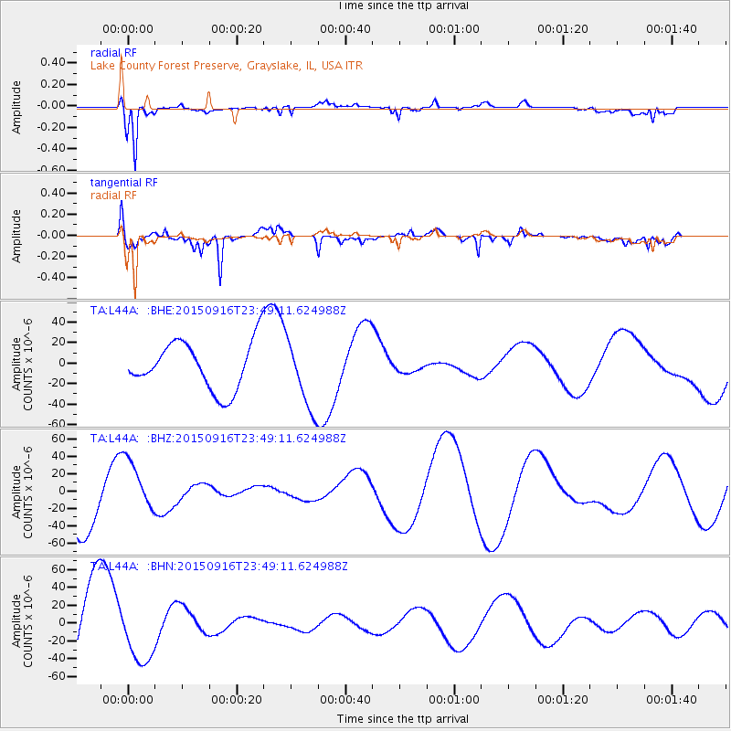
L44A Lake County Forest Preserve, Grayslake, IL, USA - Earthquake Result Viewer
*The percent match for this event was below the threshold and hence no stack was calculated.
| Earthquake location: |
Near Coast Of Central Chile |
| Earthquake latitude/longitude: |
-31.8/-72.0 |
| Earthquake time(UTC): |
2015/09/16 (259) 23:38:05 GMT |
| Earthquake Depth: |
35 km |
| Earthquake Magnitude: |
5.7 MB |
| Earthquake Catalog/Contributor: |
NEIC PDE/NEIC COMCAT |
|
| Network: |
TA USArray Transportable Network (new EarthScope stations) |
| Station: |
L44A Lake County Forest Preserve, Grayslake, IL, USA |
| Lat/Lon: |
42.18 N/87.91 W |
| Elevation: |
202 m |
|
| Distance: |
75.0 deg |
| Az: |
347.788 deg |
| Baz: |
165.973 deg |
| Ray Param: |
$rayparam |
*The percent match for this event was below the threshold and hence was not used in the summary stack. |
|
| Radial Match: |
83.94149 % |
| Radial Bump: |
400 |
| Transverse Match: |
61.031548 % |
| Transverse Bump: |
356 |
| SOD ConfigId: |
7422571 |
| Insert Time: |
2019-04-20 20:10:54.620 +0000 |
| GWidth: |
2.5 |
| Max Bumps: |
400 |
| Tol: |
0.001 |
|
Signal To Noise
| Channel | StoN | STA | LTA |
| TA:L44A: :BHZ:20150916T23:49:11.624988Z | 0.625138 | 3.095917E-5 | 4.9523744E-5 |
| TA:L44A: :BHN:20150916T23:49:11.624988Z | 0.63002414 | 3.3253058E-5 | 5.278061E-5 |
| TA:L44A: :BHE:20150916T23:49:11.624988Z | 1.6811483 | 4.4417568E-5 | 2.642097E-5 |
| Arrivals |
| Ps | |
| PpPs | |
| PsPs/PpSs | |


