You are here: Home > Network List > TA - USArray Transportable Network (new EarthScope stations) Stations List
> Station 121A Cookes Peak, Deming, NM, USA > Earthquake Result Viewer
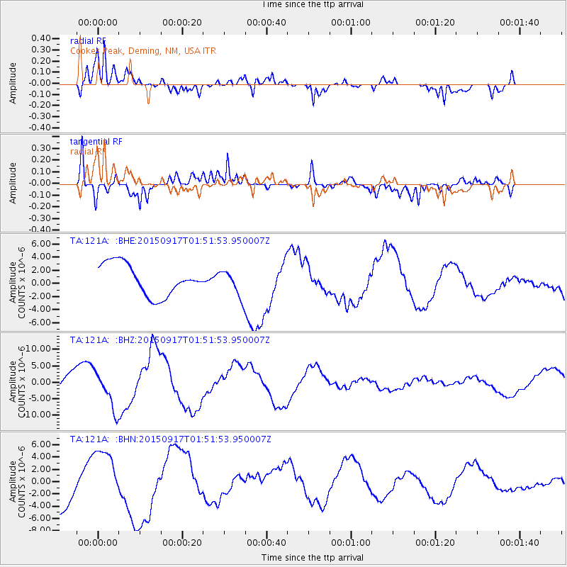
121A Cookes Peak, Deming, NM, USA - Earthquake Result Viewer
*The percent match for this event was below the threshold and hence no stack was calculated.
| Earthquake location: |
Near Coast Of Central Chile |
| Earthquake latitude/longitude: |
-31.2/-71.6 |
| Earthquake time(UTC): |
2015/09/17 (260) 01:41:09 GMT |
| Earthquake Depth: |
37 km |
| Earthquake Magnitude: |
5.6 MB |
| Earthquake Catalog/Contributor: |
NEIC PDE/NEIC COMCAT |
|
| Network: |
TA USArray Transportable Network (new EarthScope stations) |
| Station: |
121A Cookes Peak, Deming, NM, USA |
| Lat/Lon: |
32.53 N/107.79 W |
| Elevation: |
1652 m |
|
| Distance: |
72.0 deg |
| Az: |
328.378 deg |
| Baz: |
147.849 deg |
| Ray Param: |
$rayparam |
*The percent match for this event was below the threshold and hence was not used in the summary stack. |
|
| Radial Match: |
66.034 % |
| Radial Bump: |
400 |
| Transverse Match: |
68.65171 % |
| Transverse Bump: |
400 |
| SOD ConfigId: |
7422571 |
| Insert Time: |
2019-04-20 20:24:39.682 +0000 |
| GWidth: |
2.5 |
| Max Bumps: |
400 |
| Tol: |
0.001 |
|
Signal To Noise
| Channel | StoN | STA | LTA |
| TA:121A: :BHZ:20150917T01:51:53.950007Z | 1.8665855 | 6.186728E-6 | 3.314463E-6 |
| TA:121A: :BHN:20150917T01:51:53.950007Z | 1.4835259 | 4.9066994E-6 | 3.307458E-6 |
| TA:121A: :BHE:20150917T01:51:53.950007Z | 2.8802626 | 5.8263795E-6 | 2.022864E-6 |
| Arrivals |
| Ps | |
| PpPs | |
| PsPs/PpSs | |


