You are here: Home > Network List > WY - Yellowstone Wyoming Seismic Network Stations List
> Station YHH Holmes Hill, YNP, WY, USA > Earthquake Result Viewer
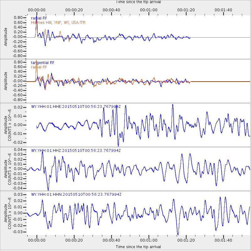
YHH Holmes Hill, YNP, WY, USA - Earthquake Result Viewer
*The percent match for this event was below the threshold and hence no stack was calculated.
| Earthquake location: |
Near Coast Of Chiapas, Mexico |
| Earthquake latitude/longitude: |
14.9/-94.0 |
| Earthquake time(UTC): |
2015/05/10 (130) 00:50:18 GMT |
| Earthquake Depth: |
6.7 km |
| Earthquake Magnitude: |
5.6 MB |
| Earthquake Catalog/Contributor: |
NEIC PDE/NEIC COMCAT |
|
| Network: |
WY Yellowstone Wyoming Seismic Network |
| Station: |
YHH Holmes Hill, YNP, WY, USA |
| Lat/Lon: |
44.79 N/110.85 W |
| Elevation: |
2717 m |
|
| Distance: |
33.1 deg |
| Az: |
337.763 deg |
| Baz: |
149.077 deg |
| Ray Param: |
$rayparam |
*The percent match for this event was below the threshold and hence was not used in the summary stack. |
|
| Radial Match: |
76.453064 % |
| Radial Bump: |
400 |
| Transverse Match: |
59.992702 % |
| Transverse Bump: |
367 |
| SOD ConfigId: |
976571 |
| Insert Time: |
2015-05-24 01:42:16.959 +0000 |
| GWidth: |
2.5 |
| Max Bumps: |
400 |
| Tol: |
0.001 |
|
Signal To Noise
| Channel | StoN | STA | LTA |
| WY:YHH:01:HHZ:20150510T00:56:23.767994Z | 6.1698737 | 1.283529E-8 | 2.0803166E-9 |
| WY:YHH:01:HHN:20150510T00:56:23.767994Z | 2.9167857 | 7.5357365E-9 | 2.5835756E-9 |
| WY:YHH:01:HHE:20150510T00:56:23.767994Z | 1.511435 | 3.8552836E-9 | 2.5507438E-9 |
| Arrivals |
| Ps | |
| PpPs | |
| PsPs/PpSs | |


