You are here: Home > Network List > IU - Global Seismograph Network (GSN - IRIS/USGS) Stations List
> Station TUC Tucson, Arizona > Earthquake Result Viewer
TUC Tucson, Arizona - Earthquake Result Viewer

| Earthquake location: |
Central Alaska |
| Earthquake latitude/longitude: |
63.5/-147.4 |
| Earthquake time(UTC): |
2002/11/03 (307) 22:12:41 GMT |
| Earthquake Depth: |
4.9 km |
| Earthquake Magnitude: |
7.0 MB, 8.5 MS, 7.9 MW |
| Earthquake Catalog/Contributor: |
WHDF/NEIC |
|
| Network: |
IU Global Seismograph Network (GSN - IRIS/USGS) |
| Station: |
TUC Tucson, Arizona |
| Lat/Lon: |
32.31 N/110.78 W |
| Elevation: |
874 m |
|
| Distance: |
38.7 deg |
| Az: |
126.103 deg |
| Baz: |
334.673 deg |
| Ray Param: |
0.075402014 |
| Estimated Moho Depth: |
18.25 km |
| Estimated Crust Vp/Vs: |
2.01 |
| Assumed Crust Vp: |
6.276 km/s |
| Estimated Crust Vs: |
3.13 km/s |
| Estimated Crust Poisson's Ratio: |
0.33 |
|
| Radial Match: |
94.57259 % |
| Radial Bump: |
293 |
| Transverse Match: |
86.36651 % |
| Transverse Bump: |
400 |
| SOD ConfigId: |
4714 |
| Insert Time: |
2010-03-04 19:49:18.360 +0000 |
| GWidth: |
2.5 |
| Max Bumps: |
400 |
| Tol: |
0.001 |
|
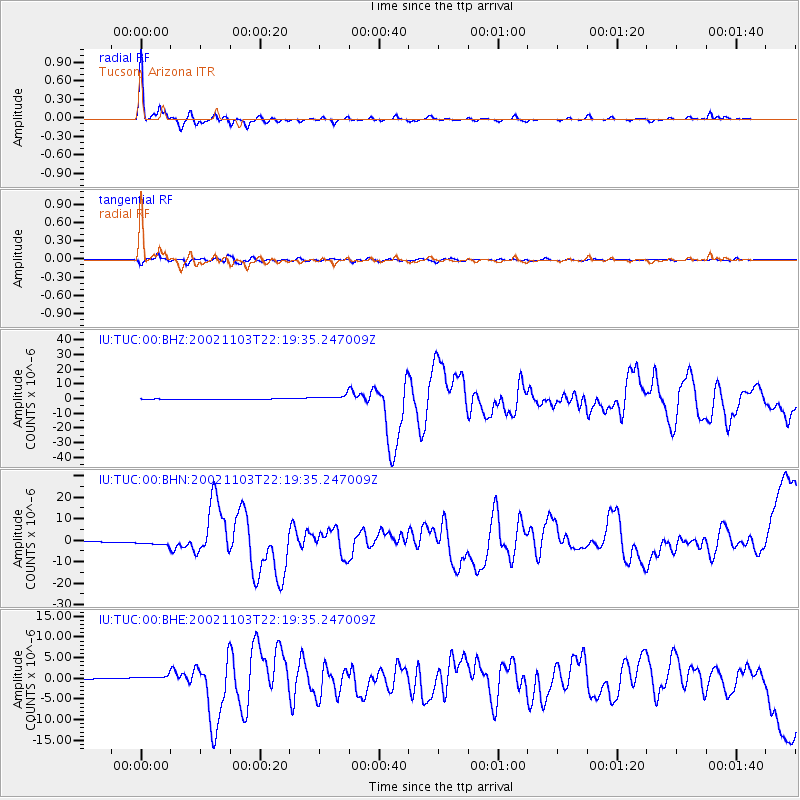
Signal To Noise
| Channel | StoN | STA | LTA |
| IU:TUC:00:BHN:20021103T22:19:35.247009Z | 6.4932537 | 1.1981177E-6 | 1.8451732E-7 |
| IU:TUC:00:BHE:20021103T22:19:35.247009Z | 5.055518 | 5.7776714E-7 | 1.14284454E-7 |
| IU:TUC:00:BHZ:20021103T22:19:35.247009Z | 11.080674 | 1.8667986E-6 | 1.6847338E-7 |
| Arrivals |
| Ps | 3.1 SECOND |
| PpPs | 8.2 SECOND |
| PsPs/PpSs | 11 SECOND |


