You are here: Home > Network List > US - United States National Seismic Network Stations List
> Station MNTX Cornudas Mountains, Texas, USA > Earthquake Result Viewer
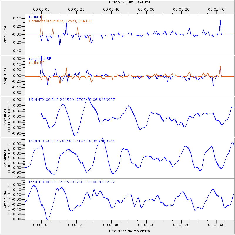
MNTX Cornudas Mountains, Texas, USA - Earthquake Result Viewer
*The percent match for this event was below the threshold and hence no stack was calculated.
| Earthquake location: |
Near Coast Of Central Chile |
| Earthquake latitude/longitude: |
-31.0/-71.5 |
| Earthquake time(UTC): |
2015/09/17 (260) 02:59:29 GMT |
| Earthquake Depth: |
35 km |
| Earthquake Magnitude: |
5.5 mwr |
| Earthquake Catalog/Contributor: |
NEIC PDE/us |
|
| Network: |
US United States National Seismic Network |
| Station: |
MNTX Cornudas Mountains, Texas, USA |
| Lat/Lon: |
31.70 N/105.38 W |
| Elevation: |
404 m |
|
| Distance: |
70.1 deg |
| Az: |
329.678 deg |
| Baz: |
149.419 deg |
| Ray Param: |
$rayparam |
*The percent match for this event was below the threshold and hence was not used in the summary stack. |
|
| Radial Match: |
44.906925 % |
| Radial Bump: |
400 |
| Transverse Match: |
69.48001 % |
| Transverse Bump: |
400 |
| SOD ConfigId: |
7422571 |
| Insert Time: |
2019-04-20 20:33:31.439 +0000 |
| GWidth: |
2.5 |
| Max Bumps: |
400 |
| Tol: |
0.001 |
|
Signal To Noise
| Channel | StoN | STA | LTA |
| US:MNTX:00:BHZ:20150917T03:10:06.848992Z | 2.0343266 | 6.327699E-7 | 3.110464E-7 |
| US:MNTX:00:BH1:20150917T03:10:06.848992Z | 1.8476864 | 5.039713E-7 | 2.7275803E-7 |
| US:MNTX:00:BH2:20150917T03:10:06.848992Z | 0.91600174 | 4.423997E-7 | 4.829682E-7 |
| Arrivals |
| Ps | |
| PpPs | |
| PsPs/PpSs | |


