You are here: Home > Network List > TA - USArray Transportable Network (new EarthScope stations) Stations List
> Station 121A Cookes Peak, Deming, NM, USA > Earthquake Result Viewer
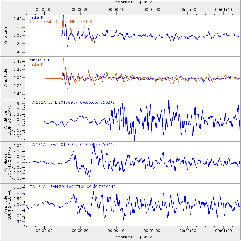
121A Cookes Peak, Deming, NM, USA - Earthquake Result Viewer
*The percent match for this event was below the threshold and hence no stack was calculated.
| Earthquake location: |
Near Coast Of Central Chile |
| Earthquake latitude/longitude: |
-31.0/-71.4 |
| Earthquake time(UTC): |
2015/09/17 (260) 03:55:07 GMT |
| Earthquake Depth: |
35 km |
| Earthquake Magnitude: |
6.2 MO |
| Earthquake Catalog/Contributor: |
NEIC PDE/NEIC ALERT |
|
| Network: |
TA USArray Transportable Network (new EarthScope stations) |
| Station: |
121A Cookes Peak, Deming, NM, USA |
| Lat/Lon: |
32.53 N/107.79 W |
| Elevation: |
1652 m |
|
| Distance: |
72.0 deg |
| Az: |
328.163 deg |
| Baz: |
147.562 deg |
| Ray Param: |
$rayparam |
*The percent match for this event was below the threshold and hence was not used in the summary stack. |
|
| Radial Match: |
87.52489 % |
| Radial Bump: |
400 |
| Transverse Match: |
63.152035 % |
| Transverse Bump: |
400 |
| SOD ConfigId: |
7422571 |
| Insert Time: |
2019-04-20 20:43:55.471 +0000 |
| GWidth: |
2.5 |
| Max Bumps: |
400 |
| Tol: |
0.001 |
|
Signal To Noise
| Channel | StoN | STA | LTA |
| TA:121A: :BHZ:20150917T04:06:06.725024Z | 1.7290342 | 3.2469086E-7 | 1.8778742E-7 |
| TA:121A: :BHN:20150917T04:06:06.725024Z | 3.4472024 | 4.1835628E-7 | 1.213611E-7 |
| TA:121A: :BHE:20150917T04:06:06.725024Z | 3.6926227 | 3.3085004E-7 | 8.959758E-8 |
| Arrivals |
| Ps | |
| PpPs | |
| PsPs/PpSs | |


