You are here: Home > Network List > TA - USArray Transportable Network (new EarthScope stations) Stations List
> Station L44A Lake County Forest Preserve, Grayslake, IL, USA > Earthquake Result Viewer
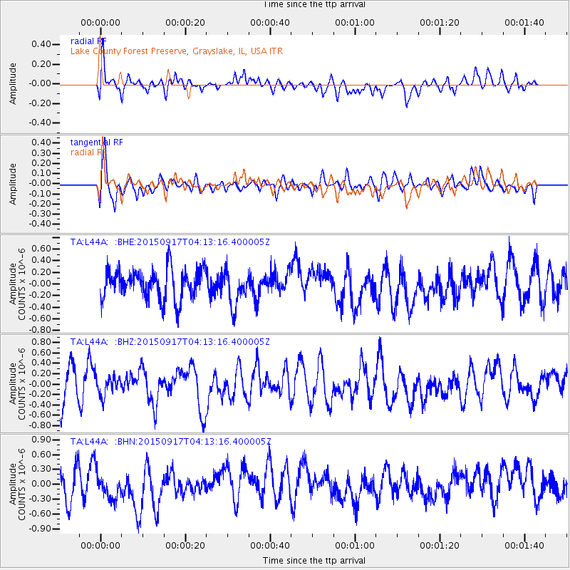
L44A Lake County Forest Preserve, Grayslake, IL, USA - Earthquake Result Viewer
*The percent match for this event was below the threshold and hence no stack was calculated.
| Earthquake location: |
Near Coast Of Central Chile |
| Earthquake latitude/longitude: |
-31.2/-71.9 |
| Earthquake time(UTC): |
2015/09/17 (260) 04:02:10 GMT |
| Earthquake Depth: |
16 km |
| Earthquake Magnitude: |
5.7 mwr |
| Earthquake Catalog/Contributor: |
NEIC PDE/us |
|
| Network: |
TA USArray Transportable Network (new EarthScope stations) |
| Station: |
L44A Lake County Forest Preserve, Grayslake, IL, USA |
| Lat/Lon: |
42.18 N/87.91 W |
| Elevation: |
202 m |
|
| Distance: |
74.5 deg |
| Az: |
347.736 deg |
| Baz: |
165.829 deg |
| Ray Param: |
$rayparam |
*The percent match for this event was below the threshold and hence was not used in the summary stack. |
|
| Radial Match: |
48.86065 % |
| Radial Bump: |
400 |
| Transverse Match: |
68.1453 % |
| Transverse Bump: |
400 |
| SOD ConfigId: |
7422571 |
| Insert Time: |
2019-04-20 20:53:29.158 +0000 |
| GWidth: |
2.5 |
| Max Bumps: |
400 |
| Tol: |
0.001 |
|
Signal To Noise
| Channel | StoN | STA | LTA |
| TA:L44A: :BHZ:20150917T04:13:16.400005Z | 0.4517382 | 1.8235983E-7 | 4.0368474E-7 |
| TA:L44A: :BHN:20150917T04:13:16.400005Z | 0.929251 | 2.7600453E-7 | 2.9701826E-7 |
| TA:L44A: :BHE:20150917T04:13:16.400005Z | 1.2026943 | 3.0925148E-7 | 2.5713226E-7 |
| Arrivals |
| Ps | |
| PpPs | |
| PsPs/PpSs | |


