You are here: Home > Network List > US - United States National Seismic Network Stations List
> Station MSO Missoula, Montana, USA > Earthquake Result Viewer
MSO Missoula, Montana, USA - Earthquake Result Viewer
*The percent match for this event was below the threshold and hence no stack was calculated.
| Earthquake location: |
Solomon Islands |
| Earthquake latitude/longitude: |
-7.2/154.4 |
| Earthquake time(UTC): |
2015/05/11 (131) 11:51:20 GMT |
| Earthquake Depth: |
39 km |
| Earthquake Magnitude: |
5.5 MB |
| Earthquake Catalog/Contributor: |
NEIC PDE/NEIC COMCAT |
|
| Network: |
US United States National Seismic Network |
| Station: |
MSO Missoula, Montana, USA |
| Lat/Lon: |
46.83 N/113.94 W |
| Elevation: |
1264 m |
|
| Distance: |
96.4 deg |
| Az: |
43.676 deg |
| Baz: |
266.273 deg |
| Ray Param: |
$rayparam |
*The percent match for this event was below the threshold and hence was not used in the summary stack. |
|
| Radial Match: |
39.45097 % |
| Radial Bump: |
400 |
| Transverse Match: |
42.047237 % |
| Transverse Bump: |
400 |
| SOD ConfigId: |
976571 |
| Insert Time: |
2015-05-25 12:21:00.742 +0000 |
| GWidth: |
2.5 |
| Max Bumps: |
400 |
| Tol: |
0.001 |
|
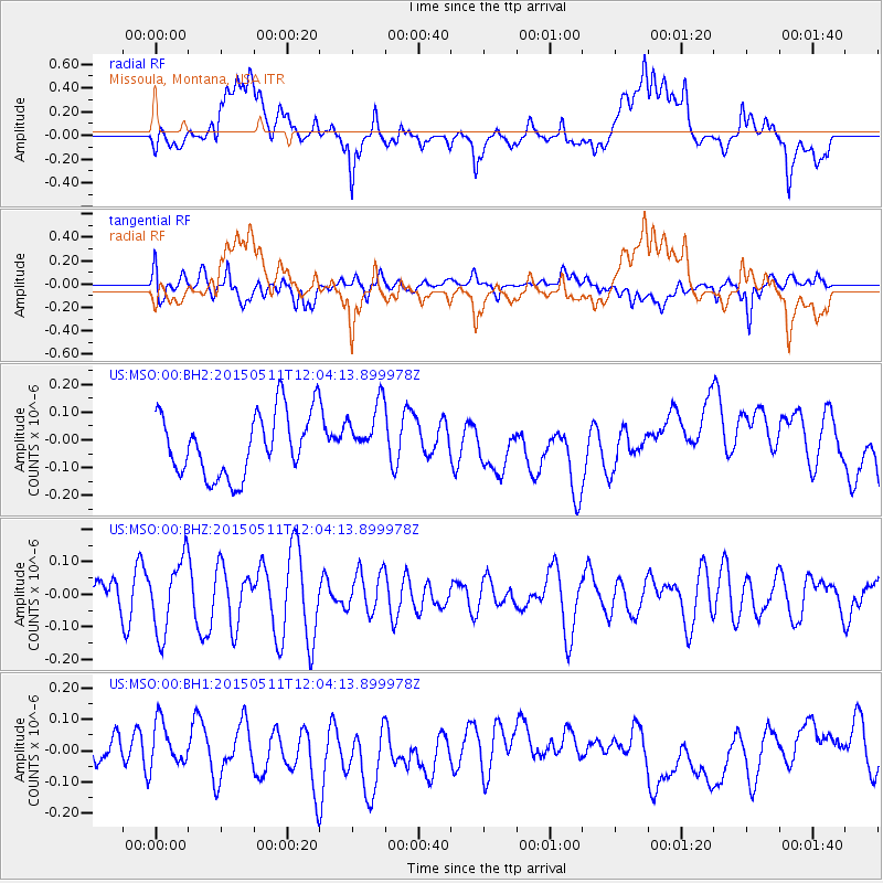
Signal To Noise
| Channel | StoN | STA | LTA |
| US:MSO:00:BHZ:20150511T12:04:13.899978Z | 2.7605333 | 1.1241528E-7 | 4.0722306E-8 |
| US:MSO:00:BH1:20150511T12:04:13.899978Z | 1.1333147 | 7.5345355E-8 | 6.6482286E-8 |
| US:MSO:00:BH2:20150511T12:04:13.899978Z | 0.9443568 | 1.06668324E-7 | 1.12953416E-7 |
| Arrivals |
| Ps | |
| PpPs | |
| PsPs/PpSs | |


