You are here: Home > Network List > TA - USArray Transportable Network (new EarthScope stations) Stations List
> Station O03E Paynes Creek, CA, USA > Earthquake Result Viewer
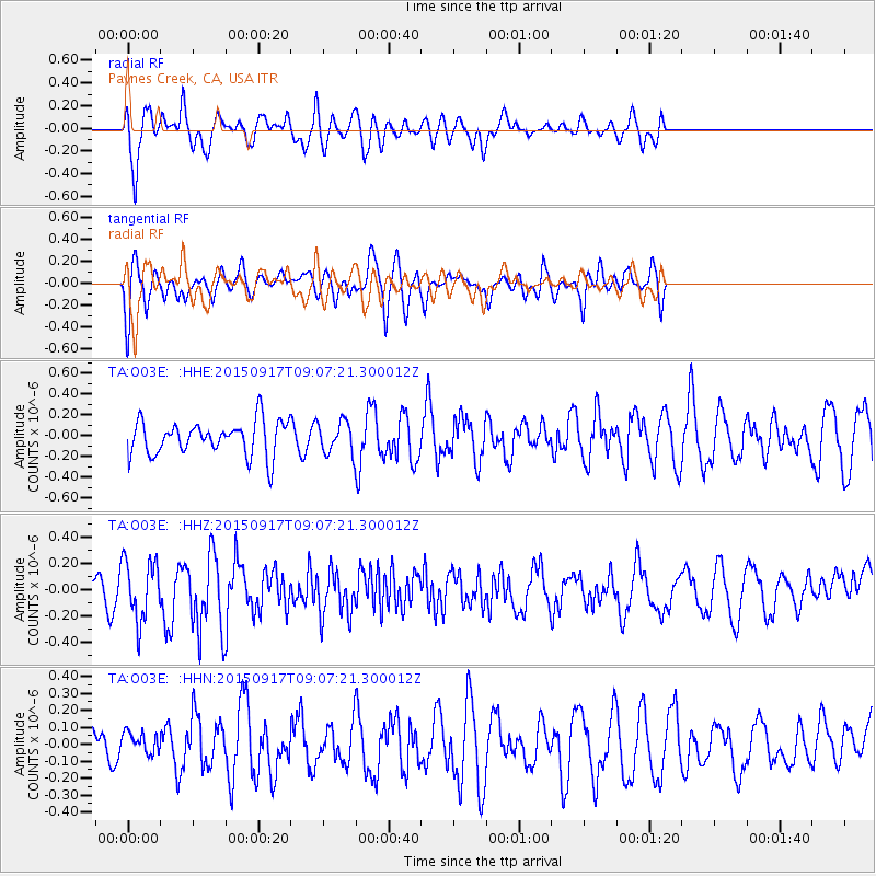
O03E Paynes Creek, CA, USA - Earthquake Result Viewer
*The percent match for this event was below the threshold and hence no stack was calculated.
| Earthquake location: |
Near East Coast Of Kamchatka |
| Earthquake latitude/longitude: |
53.3/159.7 |
| Earthquake time(UTC): |
2015/09/17 (260) 08:58:44 GMT |
| Earthquake Depth: |
69 km |
| Earthquake Magnitude: |
5.5 MB |
| Earthquake Catalog/Contributor: |
NEIC PDE/NEIC COMCAT |
|
| Network: |
TA USArray Transportable Network (new EarthScope stations) |
| Station: |
O03E Paynes Creek, CA, USA |
| Lat/Lon: |
40.29 N/121.80 W |
| Elevation: |
967 m |
|
| Distance: |
52.6 deg |
| Az: |
70.556 deg |
| Baz: |
312.266 deg |
| Ray Param: |
$rayparam |
*The percent match for this event was below the threshold and hence was not used in the summary stack. |
|
| Radial Match: |
76.65275 % |
| Radial Bump: |
400 |
| Transverse Match: |
64.426956 % |
| Transverse Bump: |
400 |
| SOD ConfigId: |
7422571 |
| Insert Time: |
2019-04-20 21:25:07.077 +0000 |
| GWidth: |
2.5 |
| Max Bumps: |
400 |
| Tol: |
0.001 |
|
Signal To Noise
| Channel | StoN | STA | LTA |
| TA:O03E: :HHZ:20150917T09:07:21.300012Z | 1.7241136 | 2.2812357E-7 | 1.3231353E-7 |
| TA:O03E: :HHN:20150917T09:07:21.300012Z | 0.4437509 | 6.8013144E-8 | 1.5326876E-7 |
| TA:O03E: :HHE:20150917T09:07:21.300012Z | 0.91676813 | 1.505542E-7 | 1.6422277E-7 |
| Arrivals |
| Ps | |
| PpPs | |
| PsPs/PpSs | |


