You are here: Home > Network List > IU - Global Seismograph Network (GSN - IRIS/USGS) Stations List
> Station FURI Mt. Furi, Ethiopia > Earthquake Result Viewer
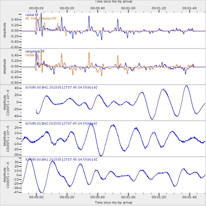
FURI Mt. Furi, Ethiopia - Earthquake Result Viewer
*The percent match for this event was below the threshold and hence no stack was calculated.
| Earthquake location: |
Nepal |
| Earthquake latitude/longitude: |
27.6/86.2 |
| Earthquake time(UTC): |
2015/05/12 (132) 07:36:53 GMT |
| Earthquake Depth: |
15 km |
| Earthquake Magnitude: |
6.3 MB |
| Earthquake Catalog/Contributor: |
NEIC PDE/NEIC COMCAT |
|
| Network: |
IU Global Seismograph Network (GSN - IRIS/USGS) |
| Station: |
FURI Mt. Furi, Ethiopia |
| Lat/Lon: |
8.90 N/38.68 E |
| Elevation: |
2570 m |
|
| Distance: |
48.4 deg |
| Az: |
256.742 deg |
| Baz: |
60.934 deg |
| Ray Param: |
$rayparam |
*The percent match for this event was below the threshold and hence was not used in the summary stack. |
|
| Radial Match: |
86.18129 % |
| Radial Bump: |
367 |
| Transverse Match: |
40.13465 % |
| Transverse Bump: |
218 |
| SOD ConfigId: |
976571 |
| Insert Time: |
2015-05-26 08:13:26.251 +0000 |
| GWidth: |
2.5 |
| Max Bumps: |
400 |
| Tol: |
0.001 |
|
Signal To Noise
| Channel | StoN | STA | LTA |
| IU:FURI:00:BHZ:20150512T07:45:04.569014Z | 0.25194553 | 3.800003E-6 | 1.5082636E-5 |
| IU:FURI:00:BH1:20150512T07:45:04.569014Z | 2.7813632 | 3.0011613E-5 | 1.0790253E-5 |
| IU:FURI:00:BH2:20150512T07:45:04.569014Z | 0.6571277 | 8.512221E-6 | 1.295368E-5 |
| Arrivals |
| Ps | |
| PpPs | |
| PsPs/PpSs | |


