RAO Raoul, Kermadec Islands - Earthquake Result Viewer
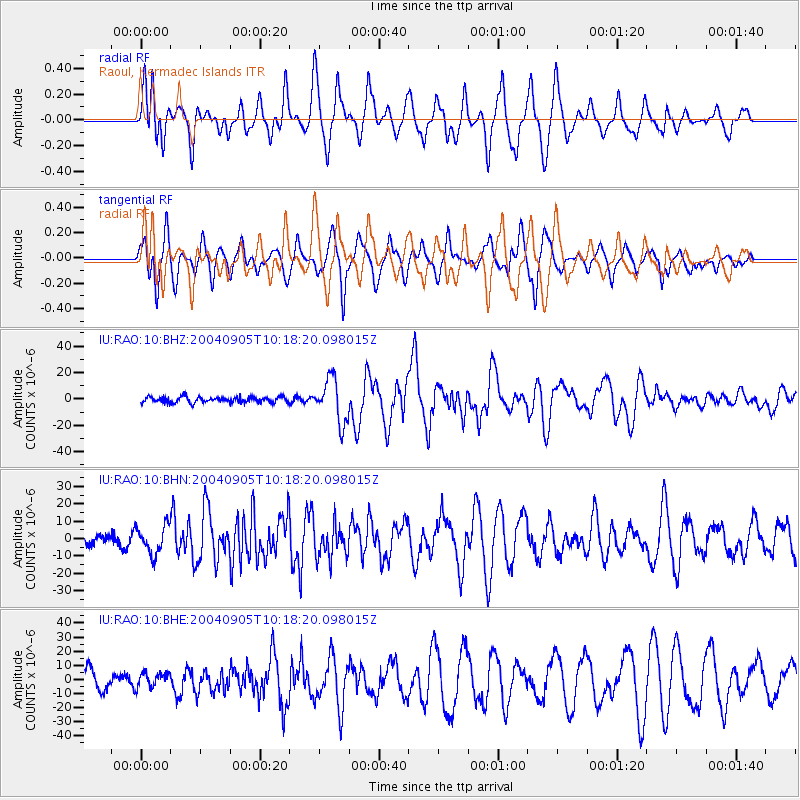
Earthquake location: Near S. Coast Of Western Honshu
Earthquake latitude/longitude: 33.1/136.6
Earthquake time(UTC): 2004/09/05 (249) 10:07:07 GMT
Earthquake Depth: 14 km
Earthquake Magnitude: 6.7 MB, 7.0 MS, 7.2 MW, 7.0 MW
Earthquake Catalog/Contributor: WHDF/NEIC
Network: IU Global Seismograph Network (GSN - IRIS/USGS)
Station: RAO Raoul, Kermadec Islands
Lat/Lon: 29.25 S/177.92 W
Elevation: 110 m
Distance: 75.5 deg
Az: 139.951 deg
Baz: 321.811 deg
Ray Param: 0.05162895
Estimated Moho Depth: 11.5 km
Estimated Crust Vp/Vs: 1.83
Assumed Crust Vp: 4.802 km/s
Estimated Crust Vs: 2.631 km/s
Estimated Crust Poisson's Ratio: 0.29
Radial Match: 86.011246 %
Radial Bump: 400
Transverse Match: 81.73574 %
Transverse Bump: 400
SOD ConfigId: 2459
Insert Time: 2010-03-04 20:02:58.365 +0000
GWidth: 2.5
Max Bumps: 400
Tol: 0.001

Signal To Noise

ChannelStoNSTALTA
IU:RAO:10:BHN:20040905T10:18:20.098015Z1.98274128.03663E-64.0532923E-6
IU:RAO:10:BHE:20040905T10:18:20.098015Z0.890845845.146129E-65.776677E-6
IU:RAO:10:BHZ:20040905T10:18:20.098015Z7.6589281.6653566E-52.1743992E-6
Arrivals
Ps2.0 SECOND
PpPs6.7 SECOND
PsPs/PpSs8.7 SECOND