
COR Corvallis, Oregon, USA - Earthquake Result Viewer
| ||||||||||||||||||
| ||||||||||||||||||
| ||||||||||||||||||
|
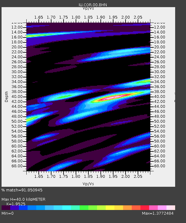
Signal To Noise
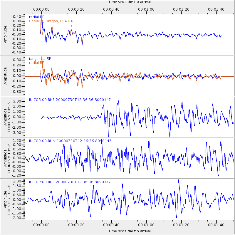
| Channel | StoN | STA | LTA |
| IU:COR:00:BHN:20000730T12:36:36.809014Z | 0.9199994 | 1.6768311E-7 | 1.8226437E-7 |
| IU:COR:00:BHE:20000730T12:36:36.809014Z | 1.2902584 | 1.861235E-7 | 1.442529E-7 |
| IU:COR:00:BHZ:20000730T12:36:36.809014Z | 2.5328898 | 4.2228564E-7 | 1.6672088E-7 |
| Arrivals | |
| Ps | 6.0 SECOND |
| PpPs | 17 SECOND |
| PsPs/PpSs | 23 SECOND |

