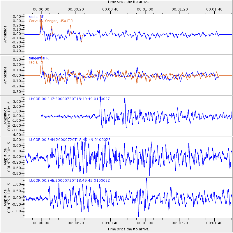
COR Corvallis, Oregon, USA - Earthquake Result Viewer
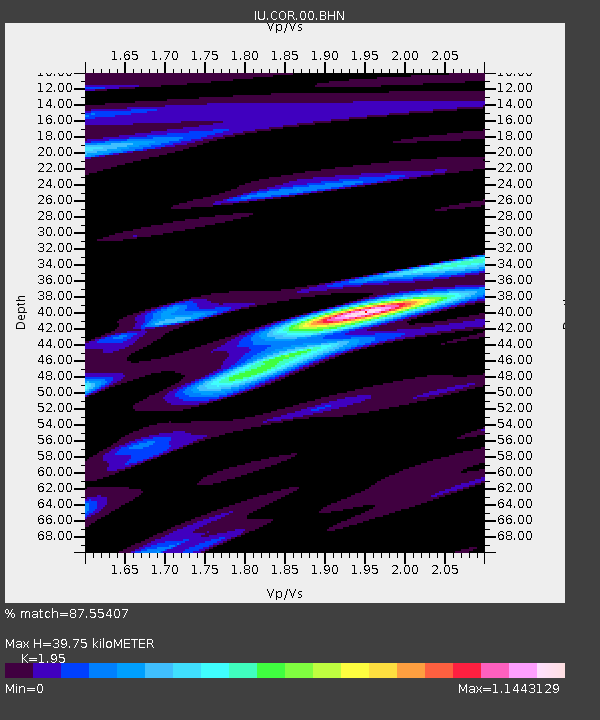
Earthquake location: Near East Coast Of Honshu, Japan
Earthquake latitude/longitude: 36.5/141.0
Earthquake time(UTC): 2000/07/20 (202) 18:39:18 GMT
Earthquake Depth: 47 km
Earthquake Magnitude: 6.1 MB, 5.4 MS, 6.1 ME, 6.0 MW
Earthquake Catalog/Contributor: WHDF/NEIC
Network: IU Global Seismograph Network (GSN - IRIS/USGS)
Station: COR Corvallis, Oregon, USA
Lat/Lon: 44.59 N/123.30 W
Elevation: 121 m
Distance: 69.1 deg
Az: 49.57 deg
Baz: 300.88 deg
Ray Param: 0.055794057
Estimated Moho Depth: 39.75 km
Estimated Crust Vp/Vs: 1.95
Assumed Crust Vp: 6.566 km/s
Estimated Crust Vs: 3.367 km/s
Estimated Crust Poisson's Ratio: 0.32
Radial Match: 87.55407 %
Radial Bump: 400
Transverse Match: 82.26176 %
Transverse Bump: 400
SOD ConfigId: 3744
Insert Time: 2010-03-04 20:03:11.574 +0000
GWidth: 2.5
Max Bumps: 400
Tol: 0.001

Signal To Noise

ChannelStoNSTALTA
IU:COR:00:BHN:20000720T18:49:49.010002Z1.82615912.1989571E-71.2041433E-7
IU:COR:00:BHE:20000720T18:49:49.010002Z2.34196572.9557575E-71.262084E-7
IU:COR:00:BHZ:20000720T18:49:49.010002Z7.62982131.1553869E-61.514304E-7
Arrivals
Ps6.0 SECOND
PpPs17 SECOND
PsPs/PpSs23 SECOND