COR Corvallis, Oregon, USA - Earthquake Result Viewer
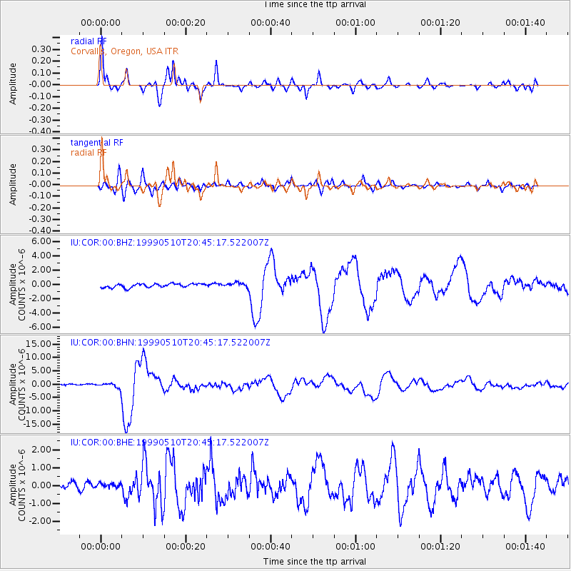
Earthquake location: New Britain Region, P.N.G.
Earthquake latitude/longitude: -5.2/150.9
Earthquake time(UTC): 1999/05/10 (130) 20:33:02 GMT
Earthquake Depth: 138 km
Earthquake Magnitude: 6.5 MB, 6.8 MS, 7.1 MW, 6.5 MB
Earthquake Catalog/Contributor: WHDF/NEIC
Network: IU Global Seismograph Network (GSN - IRIS/USGS)
Station: COR Corvallis, Oregon, USA
Lat/Lon: 44.59 N/123.30 W
Elevation: 121 m
Distance: 90.6 deg
Az: 45.454 deg
Baz: 263.416 deg
Ray Param: 0.041632876
Estimated Moho Depth: 37.25 km
Estimated Crust Vp/Vs: 2.10
Assumed Crust Vp: 6.566 km/s
Estimated Crust Vs: 3.134 km/s
Estimated Crust Poisson's Ratio: 0.35
Radial Match: 94.93311 %
Radial Bump: 368
Transverse Match: 84.02685 %
Transverse Bump: 400
SOD ConfigId: 4480
Insert Time: 2010-03-04 20:03:26.799 +0000
GWidth: 2.5
Max Bumps: 400
Tol: 0.001

Signal To Noise

ChannelStoNSTALTA
IU:COR:00:BHN:19990510T20:45:17.522007Z5.05221841.001984E-61.9832554E-7
IU:COR:00:BHE:19990510T20:45:17.522007Z0.93034351.4713368E-71.5814983E-7
IU:COR:00:BHZ:19990510T20:45:17.522007Z1.2211583.1881495E-72.610759E-7
Arrivals
Ps6.3 SECOND
PpPs17 SECOND
PsPs/PpSs24 SECOND