You are here: Home > Network List > GS - US Geological Survey Networks Stations List
> Station DEC12 Decatur Surface Seismic Site, Decatur, IL, USA > Earthquake Result Viewer
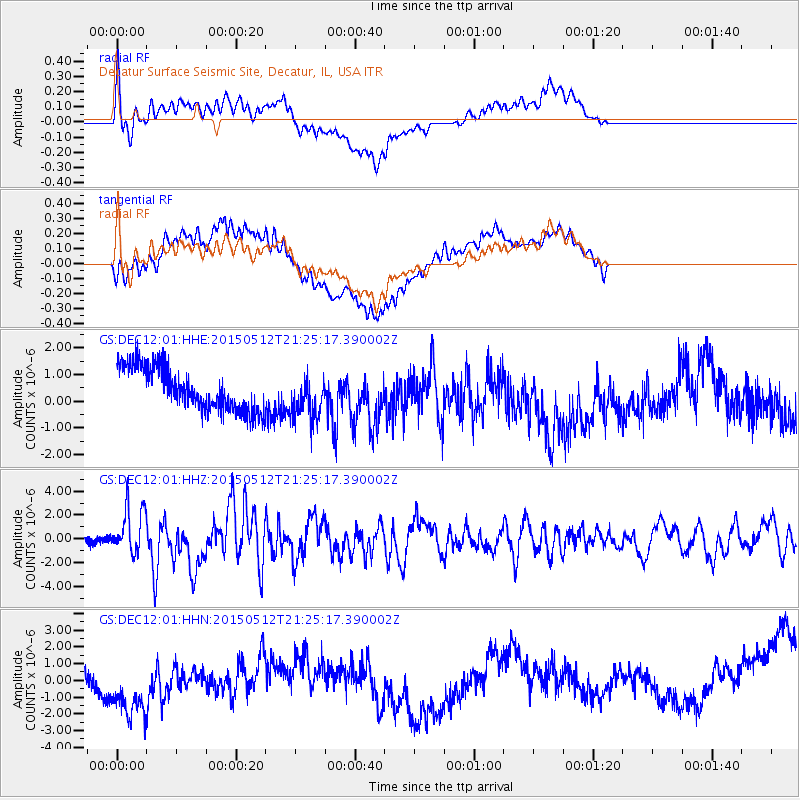
DEC12 Decatur Surface Seismic Site, Decatur, IL, USA - Earthquake Result Viewer
*The percent match for this event was below the threshold and hence no stack was calculated.
| Earthquake location: |
Near East Coast Of Honshu, Japan |
| Earthquake latitude/longitude: |
38.9/142.0 |
| Earthquake time(UTC): |
2015/05/12 (132) 21:12:58 GMT |
| Earthquake Depth: |
39 km |
| Earthquake Magnitude: |
6.8 MWP, 6.8 MI |
| Earthquake Catalog/Contributor: |
NEIC PDE/NEIC COMCAT |
|
| Network: |
GS US Geological Survey Networks |
| Station: |
DEC12 Decatur Surface Seismic Site, Decatur, IL, USA |
| Lat/Lon: |
39.91 N/88.91 W |
| Elevation: |
208 m |
|
| Distance: |
88.8 deg |
| Az: |
36.684 deg |
| Baz: |
322.699 deg |
| Ray Param: |
$rayparam |
*The percent match for this event was below the threshold and hence was not used in the summary stack. |
|
| Radial Match: |
60.12428 % |
| Radial Bump: |
400 |
| Transverse Match: |
56.72039 % |
| Transverse Bump: |
400 |
| SOD ConfigId: |
976571 |
| Insert Time: |
2015-05-26 21:26:28.031 +0000 |
| GWidth: |
2.5 |
| Max Bumps: |
400 |
| Tol: |
0.001 |
|
Signal To Noise
| Channel | StoN | STA | LTA |
| GS:DEC12:01:HHZ:20150512T21:25:17.390002Z | 8.823282 | 1.8960023E-6 | 2.148863E-7 |
| GS:DEC12:01:HHN:20150512T21:25:17.390002Z | 1.8185011 | 2.649303E-6 | 1.4568609E-6 |
| GS:DEC12:01:HHE:20150512T21:25:17.390002Z | 1.0706747 | 8.617568E-7 | 8.048727E-7 |
| Arrivals |
| Ps | |
| PpPs | |
| PsPs/PpSs | |


