You are here: Home > Network List > GS - US Geological Survey Networks Stations List
> Station KAN10 Keim Farm, Anthony, KS, USA > Earthquake Result Viewer
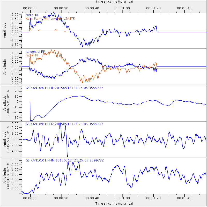
KAN10 Keim Farm, Anthony, KS, USA - Earthquake Result Viewer
*The percent match for this event was below the threshold and hence no stack was calculated.
| Earthquake location: |
Near East Coast Of Honshu, Japan |
| Earthquake latitude/longitude: |
38.9/142.0 |
| Earthquake time(UTC): |
2015/05/12 (132) 21:12:58 GMT |
| Earthquake Depth: |
39 km |
| Earthquake Magnitude: |
6.8 MWP, 6.8 MI |
| Earthquake Catalog/Contributor: |
NEIC PDE/NEIC COMCAT |
|
| Network: |
GS US Geological Survey Networks |
| Station: |
KAN10 Keim Farm, Anthony, KS, USA |
| Lat/Lon: |
37.12 N/98.10 W |
| Elevation: |
417 m |
|
| Distance: |
86.3 deg |
| Az: |
43.993 deg |
| Baz: |
317.309 deg |
| Ray Param: |
$rayparam |
*The percent match for this event was below the threshold and hence was not used in the summary stack. |
|
| Radial Match: |
28.325348 % |
| Radial Bump: |
400 |
| Transverse Match: |
29.874619 % |
| Transverse Bump: |
400 |
| SOD ConfigId: |
976571 |
| Insert Time: |
2015-05-26 21:26:58.834 +0000 |
| GWidth: |
2.5 |
| Max Bumps: |
400 |
| Tol: |
0.001 |
|
Signal To Noise
| Channel | StoN | STA | LTA |
| GS:KAN10:01:HHZ:20150512T21:25:05.359973Z | 8.461772 | 1.4231383E-6 | 1.6818444E-7 |
| GS:KAN10:01:HHN:20150512T21:25:05.359973Z | 1.5464082 | 6.8373947E-6 | 4.4214685E-6 |
| GS:KAN10:01:HHE:20150512T21:25:05.359973Z | 1.8680677 | 2.6002823E-5 | 1.3919636E-5 |
| Arrivals |
| Ps | |
| PpPs | |
| PsPs/PpSs | |


