
COR Corvallis, Oregon, USA - Earthquake Result Viewer
| ||||||||||||||||||
| ||||||||||||||||||
| ||||||||||||||||||
|
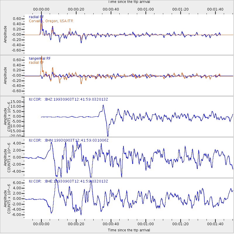
Signal To Noise
| Channel | StoN | STA | LTA |
| IU:COR: :BHN:19930903T12:41:59.031006Z | 6.7228556 | 9.718501E-7 | 1.4455912E-7 |
| IU:COR: :BHE:19930903T12:41:59.032013Z | 8.199905 | 1.2969749E-6 | 1.581695E-7 |
| IU:COR: :BHZ:19930903T12:41:59.032013Z | 11.2492285 | 2.8104703E-6 | 2.4983672E-7 |
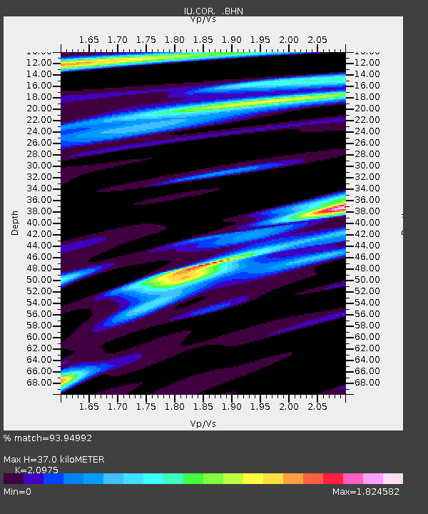
| Arrivals | |
| Ps | 6.6 SECOND |
| PpPs | 16 SECOND |
| PsPs/PpSs | 23 SECOND |

