
COR Corvallis, Oregon, USA - Earthquake Result Viewer
| ||||||||||||||||||
| ||||||||||||||||||
| ||||||||||||||||||
|
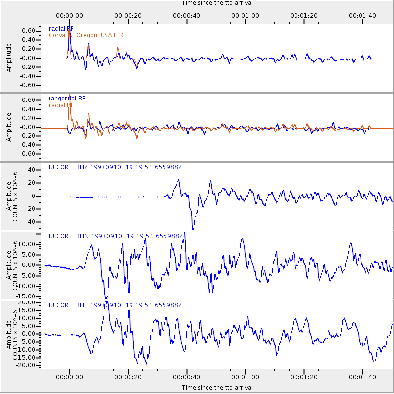
Signal To Noise
| Channel | StoN | STA | LTA |
| IU:COR: :BHN:19930910T19:19:51.655988Z | 2.0242224 | 1.3376454E-6 | 6.608194E-7 |
| IU:COR: :BHE:19930910T19:19:51.655988Z | 1.9758072 | 6.838927E-7 | 3.4613333E-7 |
| IU:COR: :BHZ:19930910T19:19:51.655988Z | 2.4848719 | 1.3639831E-6 | 5.4891484E-7 |
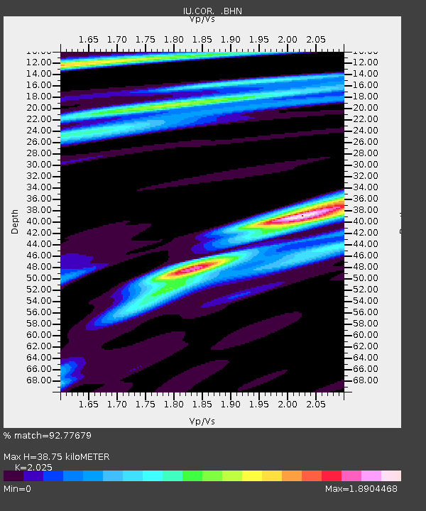
| Arrivals | |
| Ps | 6.5 SECOND |
| PpPs | 17 SECOND |
| PsPs/PpSs | 23 SECOND |

