
COR Corvallis, Oregon, USA - Earthquake Result Viewer
| ||||||||||||||||||
| ||||||||||||||||||
| ||||||||||||||||||
|
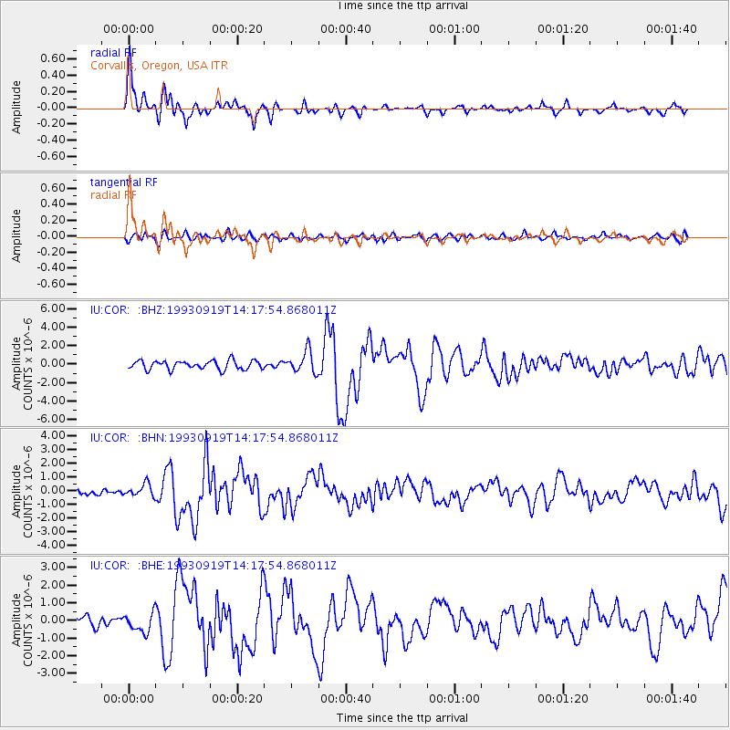
Signal To Noise
| Channel | StoN | STA | LTA |
| IU:COR: :BHN:19930919T14:17:54.868011Z | 1.7890624 | 4.7188382E-7 | 2.637604E-7 |
| IU:COR: :BHE:19930919T14:17:54.868011Z | 2.0400875 | 5.394299E-7 | 2.644151E-7 |
| IU:COR: :BHZ:19930919T14:17:54.868011Z | 2.5013316 | 1.1886398E-6 | 4.752028E-7 |
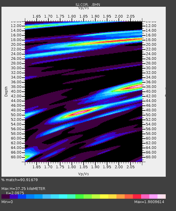
| Arrivals | |
| Ps | 6.6 SECOND |
| PpPs | 17 SECOND |
| PsPs/PpSs | 23 SECOND |

